Category:Goldenhill, Staffordshire
Jump to navigation
Jump to search
area on the northern edge of Stoke-on-Trent, in Staffordshire, England  | |||||
| Upload media | |||||
| Instance of | |||||
|---|---|---|---|---|---|
| Location | City of Stoke-on-Trent, Staffordshire, West Midlands, England | ||||
 | |||||
Subcategories
This category has the following 2 subcategories, out of 2 total.
G
- St John's Church, Goldenhill (4 F)
Media in category "Goldenhill, Staffordshire"
The following 21 files are in this category, out of 21 total.
-
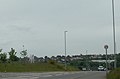
 A50, Kidsgrove Road - geograph.org.uk - 3517016.jpg 640 × 493; 48 KB
-
 A527 heading for Great Chell - geograph.org.uk - 3517036.jpg 640 × 424; 42 KB
-
 A527, James Brindley Way - geograph.org.uk - 3517026.jpg 800 × 568; 79 KB
-
 By a Sleepy Lagoon - geograph.org.uk - 192174.jpg 640 × 480; 104 KB
-
 Derelict church building in Goldenhill - geograph.org.uk - 5256513.jpg 1,600 × 1,200; 747 KB
-
 Driving Range, closed - geograph.org.uk - 4279975.jpg 640 × 480; 131 KB
-
 Entrance to covered reservoir - geograph.org.uk - 197211.jpg 640 × 480; 29 KB
-
 Gilbert Street, Goldenhill - geograph.org.uk - 5025625.jpg 1,600 × 1,200; 542 KB
-
 Goldenhill High Street.jpg 1,600 × 1,200; 566 KB
-
 Goodies Bake Shop - Sandyford - geograph.org.uk - 3990685.jpg 2,987 × 2,114; 2.52 MB
-
 Heath Street, Goldenhill - geograph.org.uk - 5024876.jpg 1,600 × 1,200; 479 KB
-
 Heathfield Court Sheltered Housing - Goldenhill - geograph.org.uk - 3990698.jpg 3,633 × 2,101; 3.74 MB
-
 Industrial unit, Marlborough Way - geograph.org.uk - 2503330.jpg 640 × 480; 53 KB
-
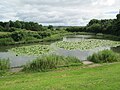 Lake at Goldenhill - geograph.org.uk - 5026152.jpg 1,600 × 1,200; 682 KB
-
 Reservoir and mobile phone masts - geograph.org.uk - 198174.jpg 640 × 480; 27 KB
-
 Rodgers Street, Goldenhill - geograph.org.uk - 5256520.jpg 1,600 × 1,200; 517 KB
-
 Sandyford cricket ground - geograph.org.uk - 5024867.jpg 1,600 × 1,200; 507 KB
-
 Shops at Goldenhill - geograph.org.uk - 5026134.jpg 1,600 × 1,200; 594 KB
-
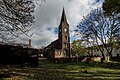 St. Johns Church (Disused), Goldenhill - geograph.org.uk - 6336869.jpg 2,000 × 1,333; 3.08 MB
-
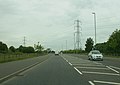
 The main road north of Tunstall - geograph.org.uk - 5024859.jpg 1,600 × 1,200; 419 KB
-
 Track past Latebrook House - geograph.org.uk - 198167.jpg 640 × 480; 40 KB


,_Goldenhill_-_geograph.org.uk_-_6336869.jpg)

