Category:Goad fire insurance maps of Quebec
Jump to navigation
Jump to search
Subcategories
This category has the following 2 subcategories, out of 2 total.
Media in category "Goad fire insurance maps of Quebec"
The following 4 files are in this category, out of 4 total.
-
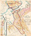
Plan showing extent of Ottawa-Hull Conflagration.jpg 2,400 × 2,826; 2.4 MB
-
Plan showing extent of Ottawa-Hull fire 1900.jpg 1,687 × 2,075; 924 KB


