Category:Gniezno on maps
Jump to navigation
Jump to search
Media in category "Gniezno on maps"
The following 16 files are in this category, out of 16 total.
-
 Church in poland 12-13c-es.svg 2,281 × 2,000; 3.39 MB
-
 Church in poland 12-13c-pt.svg 2,281 × 2,000; 3.48 MB
-
 Church in poland 12-13c.svg 742 × 651; 3.35 MB
-
 De Regno et tota regione Poloniae, S. Münster, Cosmographia universalis.png 1,845 × 1,465; 1.3 MB
-
 Duchy of Warsaw and Republic of Danzig.JPG 770 × 724; 187 KB
-
 Fotothek df tg 0005105 Geographie ^ Karte.jpg 800 × 661; 289 KB
-
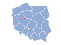 Gniezno map.png 580 × 425; 54 KB
-
 IRP 1466.PNG 2,420 × 2,232; 1.24 MB
-
 Karte des Gnesener Kreises, Berlin 1839.djvu 5,775 × 4,110; 2.09 MB
-
 Karte des Gnesener Kreises, Berlin 1844 (verlag- C. Heymann).jpg 13,396 × 10,753; 27.01 MB
-
 Karte des Gnesener Kreises,1839.jpg 5,775 × 4,110; 4.02 MB
-
 POL Gniezno map.svg 497 × 463; 47 KB
-
 Poland1291-cs.png 1,187 × 1,039; 569 KB
-
 Polen in den Grenzen vor 1660.jpg 731 × 561; 409 KB
-
 Poloniae et Ungariae Münstera.jpg 1,000 × 786; 324 KB
-
 Sebastian Münster, Cosmographia- Gdańsk, Gniezno, Poznań, Toruń.png 310 × 463; 58 KB


.jpg)


