Category:Glenluce
Jump to navigation
Jump to search
village in Dumfries and Galloway, Scotland, UK | |||||
| Upload media | |||||
| Instance of | |||||
|---|---|---|---|---|---|
| Location |
| ||||
| Population |
| ||||
 | |||||
Glenluce ( Gaelic: Clachan Ghlinn Lus, ) is a village in the Civil Parish area en:Old Luce, Wigtownshire in en:Wigtownshire within the District Council Region of en:Dumfries and Galloway in en:Scotland.
Gàidhlig: 'S e baile ann an Dùn Phris is Gall-Ghaidhealaibh a tha ann an Clachan Ghlinn Lus (Beurla: Glenluce). Tha e suidhichte air a' mhòr-rathaid A75 road eadar An t-Sròn Reamhar agus Newton Stewart anns an Siorrachd traidiseanta Baile na h-Uige. 'S e seo na co-chomharran aige: 54° 52′ 40.8″ Tuath agus 4° 48′ 39.6″ Iar.
Slovenščina: Glenluce ( gelsko Clachan Ghlinn Lus, [kɫ̪axan ɣliɲˈɫ̪us̪]) je vas v škotskem območju Dumfries in Galloway.
Subcategories
This category has the following 6 subcategories, out of 6 total.
G
- Glenluce Abbey (91 F)
- Glenluce railway station (2 F)
L
- Luce Viaduct (17 F)
P
- Castle of Park (20 F)
W
- Whitecairn Caravan Park (2 F)
- Whitefield Loch (11 F)
Media in category "Glenluce"
The following 30 files are in this category, out of 30 total.
-
Bridgemill Business Park, Glenluce - geograph.org.uk - 163858.jpg 640 × 480; 101 KB
-
Campsite in Glenluce - geograph.org.uk - 1285317.jpg 640 × 427; 115 KB
-
Corsehead Farm - geograph.org.uk - 431872.jpg 640 × 480; 108 KB
-
Galloway Inventory 1912 Figure 80 fourthandfifthre00scot 0246.jpg 878 × 2,847; 413 KB
-
Glenluce - geograph.org.uk - 2226959.jpg 640 × 480; 81 KB
-
Glenluce - geograph.org.uk - 2227012.jpg 640 × 480; 80 KB
-
Glenluce - geograph.org.uk - 3864930.jpg 1,920 × 1,280; 1.59 MB
-
Glenluce - looking down the Main Street - geograph.org.uk - 619409.jpg 640 × 543; 104 KB
-
Glenluce Anderson 1881b Fig 61 scotlandinearlyc00anderich 0123.jpg 718 × 2,230; 622 KB
-
In Balkail Glen - geograph.org.uk - 581170.jpg 480 × 640; 153 KB
-
Loddon River at Vaughn Springs - panoramio.jpg 2,048 × 1,536; 2.16 MB
-
Main street in Glenluce - geograph.org.uk - 163897.jpg 640 × 480; 77 KB
-
Main Street in Glenluce - geograph.org.uk - 316454.jpg 640 × 480; 64 KB
-
Mains of Park near Glenluce - geograph.org.uk - 163857.jpg 640 × 480; 103 KB
-
Mapa Chachlain Ghlinn Lus.jpg 2,004 × 1,363; 599 KB
-
Mapa Chlachain Ghlinn Lus DG.jpg 2,004 × 1,363; 599 KB
-
Old Port William Road, Glenluce - geograph.org.uk - 163158.jpg 640 × 480; 97 KB
-
Old road at Glenluce - geograph.org.uk - 163896.jpg 640 × 480; 94 KB
-
Old road at Glenluce - geograph.org.uk - 316196.jpg 640 × 480; 65 KB
-
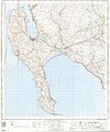
Ordnance Survey One-Inch Sheet 79 Stranraer, Published 1963.jpg 8,251 × 9,867; 8.1 MB
-
Ordnance Survey One-Inch Sheet 90 Stranraer, Published 1924.jpg 8,749 × 12,457; 8.71 MB
-
Sileadh agus Teothachd ann an Clachan Ghlinn Lus.jpg 573 × 336; 35 KB
-
The Nitbank - geograph.org.uk - 669842.jpg 640 × 480; 102 KB
-
Torwood House Country Hotel - geograph.org.uk - 163178.jpg 640 × 480; 102 KB
-
Vintage tractor show - geograph.org.uk - 359281.jpg 640 × 480; 99 KB
-
Vintage tractors - geograph.org.uk - 359290.jpg 640 × 480; 120 KB


