Category:Glencaple, Dumfries and Galloway
Jump to navigation
Jump to search
village in Dumfries and Galloway, Scotland, UK   | |||||
| Upload media | |||||
| Instance of | |||||
|---|---|---|---|---|---|
| Location |
| ||||
| Located in or next to body of water | |||||
 | |||||
English: Glencaple is a small settlement in the District Council Region of Dumfries and Galloway, Scotland. Situated on the banks of the River Nith, it once served as a port for nearby Dumfries.
Dumfries F.C. play their home matches at Norfolk Park in Glencaple.
Media in category "Glencaple, Dumfries and Galloway"
The following 71 files are in this category, out of 71 total.
-
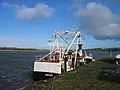
 'Alison Louise' at Glencaple - geograph.org.uk - 4805361.jpg 3,264 × 2,448; 2.18 MB
-
 Alison Louise's Business End - geograph.org.uk - 2832338.jpg 3,010 × 3,111; 3.31 MB
-
 Beacon at Glencaple - geograph.org.uk - 21298.jpg 480 × 640; 96 KB
-
 Bird tracks on tidal mud at Glencaple - geograph.org.uk - 3409614.jpg 640 × 458; 214 KB
-
 Boat tied up at Glencaple Quay - geograph.org.uk - 1204703.jpg 640 × 480; 61 KB
-
 Buildings at Townfoot - geograph.org.uk - 609854.jpg 640 × 440; 86 KB
-

-
 Cattle feeding in the mud - geograph.org.uk - 609844.jpg 640 × 480; 97 KB
-
 Conheath Woodland - geograph.org.uk - 1068133.jpg 532 × 640; 77 KB
-
 Core path 37 - geograph.org.uk - 6472885.jpg 4,032 × 1,960; 3.34 MB
-
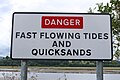 Danger Sign by the Nith - geograph.org.uk - 5846941.jpg 2,976 × 1,984; 2.81 MB
-
 Fire Beacon, Glencaple - geograph.org.uk - 4064136.jpg 1,920 × 1,280; 1.38 MB
-
 Fire lantern - geograph.org.uk - 4014843.jpg 3,648 × 2,736; 3.46 MB
-
 Gate, gorse and Criffel - geograph.org.uk - 406311.jpg 640 × 480; 113 KB
-
 Glencaple (45524370555).jpg 4,428 × 2,181; 5.85 MB
-
 Glencaple - geograph.org.uk - 3086164.jpg 1,600 × 1,200; 317 KB
-
 Glencaple - geograph.org.uk - 392296.jpg 640 × 480; 97 KB
-
 Glencaple from Glencaple Quay, River Nith.jpg 4,896 × 2,752; 4.31 MB
-
 Glencaple Lifeboat - geograph.org.uk - 942458.jpg 640 × 427; 50 KB
-
 Glencaple Village - geograph.org.uk - 118283.jpg 640 × 480; 111 KB
-
-
 Gorse hedge and Criffel - geograph.org.uk - 406270.jpg 640 × 480; 109 KB
-
 Greenmill Burn - geograph.org.uk - 1068547.jpg 640 × 480; 98 KB
-
 Ice floes on the river Nith - geograph.org.uk - 2733317.jpg 480 × 640; 86 KB
-
 Lochar Water at Bankend - geograph.org.uk - 565460.jpg 640 × 480; 184 KB
-
 Log Seat by the Nith - geograph.org.uk - 5846930.jpg 2,976 × 1,984; 3.72 MB
-
 Looking down the River Nith - geograph.org.uk - 4800891.jpg 3,264 × 2,448; 3.58 MB
-
 Low tide at Glencaple - geograph.org.uk - 3360995.jpg 1,600 × 835; 204 KB
-
 Merkland Cottage - geograph.org.uk - 596242.jpg 640 × 480; 59 KB
-
 Merse ditch - geograph.org.uk - 609869.jpg 639 × 479; 71 KB
-
 Millennium cairn - geograph.org.uk - 609830.jpg 480 × 640; 101 KB
-
 Mud on the bank of the Nith - geograph.org.uk - 4800873.jpg 3,264 × 2,448; 4.1 MB
-
 Mudflats at dusk - geograph.org.uk - 1469100.jpg 640 × 428; 28 KB
-
 NCN Millennium Milepost MP349 Glencaple.jpeg 1,600 × 1,064; 625 KB
-
 Nith Estuary - geograph.org.uk - 20389.jpg 640 × 480; 52 KB
-
 Nith Estuary south of Glencaple - geograph.org.uk - 3926173.jpg 1,024 × 681; 162 KB
-
 Reed bed by the River Nith - geograph.org.uk - 4800884.jpg 3,264 × 2,448; 3.04 MB
-
 River Nith - geograph.org.uk - 1068145.jpg 554 × 640; 57 KB
-
 River Nith - geograph.org.uk - 5846924.jpg 2,976 × 1,984; 2.68 MB
-
 River Nith - geograph.org.uk - 5846925.jpg 2,976 × 1,984; 2.99 MB
-
 River Nith at Glencaple - geograph.org.uk - 1204700.jpg 640 × 480; 57 KB
-
 River Nith at Glencaple - geograph.org.uk - 1204714.jpg 640 × 480; 74 KB
-
 River Nith at Glencaple - geograph.org.uk - 1204716.jpg 640 × 480; 67 KB
-
 River Nith at Glencaple - geograph.org.uk - 5363290.jpg 640 × 480; 46 KB
-
 River Nith from Glencaple Quay - geograph.org.uk - 1204707.jpg 640 × 480; 65 KB
-
 River Nith From Glencaple Quay - geograph.org.uk - 2831143.jpg 4,592 × 3,448; 2.8 MB
-
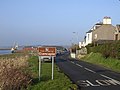
 Road junction at Glencaple - geograph.org.uk - 1135463.jpg 640 × 481; 60 KB
-
 Rusting boat at Glencaple quay - geograph.org.uk - 3926176.jpg 1,024 × 681; 151 KB
-
 Rusty UK 27 - geograph.org.uk - 609813.jpg 640 × 480; 74 KB
-
 Sheep and lambs - geograph.org.uk - 406340.jpg 640 × 480; 78 KB
-
 Stream Channel Near Glencaple Quay - geograph.org.uk - 2831187.jpg 3,448 × 4,592; 4.13 MB
-
 Sundown At Glencaple - geograph.org.uk - 6039789.jpg 640 × 389; 53 KB
-
 The 'Alison Louise' At Glencaple Quay - geograph.org.uk - 2831175.jpg 3,448 × 4,592; 2.46 MB
-
 The Boathouse restaurant, Glencaple Quay, River Nith.jpg 4,896 × 2,752; 4.09 MB
-
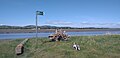
 The Caerlaverock Cairn at Glencaple - geograph.org.uk - 942466.jpg 640 × 427; 63 KB
-
 The Nith Estuary - geograph.org.uk - 5846927.jpg 2,976 × 1,984; 2.74 MB
-
 The Nith Estuary - geograph.org.uk - 621753.jpg 640 × 480; 122 KB
-
 The old Free Church of Scotland, Glencaple, Dumfries and Galloway.jpg 4,896 × 2,752; 2.52 MB
-
 The River Nith - geograph.org.uk - 5846938.jpg 2,976 × 1,984; 2.12 MB
-
 The River Nith at Glencaple - geograph.org.uk - 4064192.jpg 1,920 × 1,280; 1.46 MB
-
 The River Nith at Glencaple - geograph.org.uk - 4064195.jpg 1,920 × 1,280; 1.51 MB
-
 The river Nith at Glencaple - geograph.org.uk - 4800831.jpg 3,264 × 2,448; 4.25 MB
-
 The River Nith mudflats at sundown - geograph.org.uk - 1469107.jpg 640 × 428; 40 KB
-
 The tidal River Nith downstream of Glencaple Quay - geograph.org.uk - 6388480.jpg 1,600 × 1,200; 277 KB
-
 The tidal River Nith upstream from Glencaple Quay - geograph.org.uk - 6388473.jpg 1,600 × 1,200; 292 KB
-
 The tidal River Nith, near Gullsway - geograph.org.uk - 6387430.jpg 1,600 × 1,200; 372 KB
-
 Tidal sand and mud at Glencaple - geograph.org.uk - 3409657.jpg 640 × 480; 211 KB
-
 Track from Merkland to Stank - geograph.org.uk - 596225.jpg 640 × 480; 68 KB
-
 Track Towards Black Grain Plantation - geograph.org.uk - 565458.jpg 640 × 480; 181 KB
-
 View over River Nith at sunset - geograph.org.uk - 1469104.jpg 428 × 640; 22 KB
-
 View towards Criffel from Glencaple - geograph.org.uk - 4372814.jpg 1,500 × 1,000; 301 KB


.jpg)


