Category:Glaciological maps of Alaska
Jump to navigation
Jump to search
Subcategories
This category has only the following subcategory.
M
Media in category "Glaciological maps of Alaska"
The following 5 files are in this category, out of 5 total.
-
 Glacier Bay Glacial Extent.png 371 × 576; 64 KB
-
 Glacier Bay National Park NPS map of glacial ice extent in 1794.jpg 2,988 × 5,312; 1.99 MB
-
 Glacier Bay National Park NPS map of glacial ice extent in 1879.jpg 2,988 × 5,312; 1.89 MB
-
 Glacier National Park NPS map of glacial ice extent in 1980.jpg 2,988 × 5,312; 2.07 MB
-
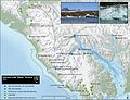 NPS glacier-bay-water-terminus-map.jpg 2,094 × 1,603; 798 KB


