Category:Glückstadt range front (1937)
Jump to navigation
Jump to search
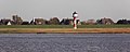
Deutsch: Das Unterfeuer Glückstadt, 1936/1937 erbaut in der Blomeschen Wildnis bei Glückstadt an der Elbe
| Object location | | View all coordinates using: OpenStreetMap |
|---|
lighthouse in Schleswig-Holstein, Germany  | |||||
| Upload media | |||||
| Instance of | |||||
|---|---|---|---|---|---|
| Part of |
| ||||
| Location | Glückstadt, Steinburg, Schleswig-Holstein, Germany | ||||
| Located in or next to body of water | |||||
| Inception |
| ||||
| Height |
| ||||
 | |||||
Media in category "Glückstadt range front (1937)"
The following 10 files are in this category, out of 10 total.
-
 Amrum Wittduen Laternen Glueckstadt.jpg 3,264 × 2,448; 2.19 MB
-
 Blomesche Wildnis - panoramio (1).jpg 3,648 × 2,736; 1.25 MB
-
 Blomesche Wildnis - panoramio.jpg 3,648 × 2,736; 2.77 MB
-
 Elbfaehre 2018 by-RaBoe 082.jpg 3,666 × 2,435; 485 KB
-
 Elbfaehre 2018 by-RaBoe 083.jpg 3,666 × 2,435; 445 KB
-
 Faehranleger Glueckstadt 2011-by-RaBoe-02.jpg 1,056 × 666; 495 KB
-
 Faehranleger Glueckstadt 2011-by-RaBoe-10.jpg 1,111 × 448; 399 KB
-
 Glueckstadt Leuchtturm.jpg 2,623 × 3,563; 3.11 MB
-
 Schleswig-Holstein, Blomesche Wildnis, Neubau Unterfeuer Glückstadt NIK 3340.jpg 5,619 × 3,747; 15.79 MB
-
 Schleswig-Holstein, Blomesche Wildnis, Neubau Unterfeuer Glückstadt NIK 3357.jpg 6,000 × 4,000; 9.53 MB

.jpg)


Categories:
- Lighthouses by height, 11 to 20 meters
- Built in Schleswig-Holstein in 1937
- Lighthouses by range, 15 to 19 nm
- Destroyed lighthouses in Germany
- Concrete lighthouses in Germany
- Lighthouses in Germany by name
- Lighthouses built in 1937
- Glückstadt range lights
- History of Glückstadt
- Landfall lights
- FFH-Gebiet Schleswig-Holsteinisches Elbästuar und angrenzende Flächen