Category:Gilston, Hertfordshire
Jump to navigation
Jump to search
English: Gilston is a village near the town of Harlow and the village of High Wych, in Hertfordshire.
village and civil parish in East Hertfordshire, Hertfordshire, UK  | |||||
| Upload media | |||||
| Pronunciation audio | |||||
|---|---|---|---|---|---|
| Instance of | |||||
| Part of |
| ||||
| Location | East Hertfordshire, Hertfordshire, East of England, England | ||||
 | |||||
Subcategories
This category has the following 4 subcategories, out of 4 total.
G
- Gilston Park (2 F)
- Gilston War Memorial (1 F)
M
- St Marys Church, Gilston (9 F)
P
- Plume of Feathers, Gilston (2 F)
Media in category "Gilston, Hertfordshire"
The following 39 files are in this category, out of 39 total.
-
 'The Moorhen' inn and restaurant - geograph.org.uk - 1246788.jpg 640 × 452; 71 KB
-
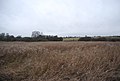
 Almost harvest time - geograph.org.uk - 2801872.jpg 640 × 470; 75 KB
-
 Approaching Harlow Marsh Nature Reserve - geograph.org.uk - 4917025.jpg 424 × 640; 124 KB
-
 Bridge to Honeymead Marsh - geograph.org.uk - 4917001.jpg 640 × 424; 62 KB
-
 Concrete Factory - geograph.org.uk - 3539475.jpg 640 × 430; 118 KB
-
 Corner of Golden Grove - geograph.org.uk - 3895087.jpg 640 × 480; 230 KB
-
 Cumberland Lodge - geograph.org.uk - 1445243.jpg 640 × 480; 195 KB
-
 Disused working at Hollingson Meads - geograph.org.uk - 5462119.jpg 3,264 × 2,448; 3.63 MB
-
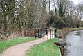
 Foot Bridge - geograph.org.uk - 1324796.jpg 640 × 425; 88 KB
-
 Footbridge - geograph.org.uk - 258523.jpg 640 × 480; 124 KB
-
 Footbridge, Harcamlow Way - geograph.org.uk - 3539470.jpg 640 × 430; 85 KB
-
 Footpath junction - geograph.org.uk - 3539468.jpg 640 × 430; 79 KB
-
 Gilston - church and cottages - geograph.org.uk - 1445300.jpg 640 × 480; 110 KB
-
 Harcamlow Way along the River Stort - geograph.org.uk - 3539458.jpg 640 × 430; 77 KB
-
 Harlow Town (former Burnt Mill) Station - geograph.org.uk - 1951296.jpg 640 × 393; 107 KB
-
 Hybrid Bluebells in Harlow Marsh LNR - geograph.org.uk - 4917039.jpg 640 × 424; 121 KB
-
 Latton Island, River Stort - geograph.org.uk - 3539482.jpg 640 × 430; 86 KB
-
 Maymeads Marsh Nature Reserve - geograph.org.uk - 3539455.jpg 640 × 430; 59 KB
-
 Maymeads Marsh Nature Reserve - geograph.org.uk - 3539459.jpg 640 × 430; 59 KB
-
 Maymeads Marsh Nature Reserve - geograph.org.uk - 3539461.jpg 640 × 430; 61 KB
-
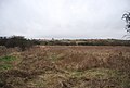
 Near Channocks Farm - geograph.org.uk - 2801871.jpg 640 × 437; 67 KB
-

-
 Only a Permissive Path - geograph.org.uk - 4917009.jpg 640 × 424; 71 KB
-
 Overhall Farm - geograph.org.uk - 1445251.jpg 640 × 480; 74 KB
-
 Plume of Feathers pub, Gilston - geograph.org.uk - 4778617.jpg 4,320 × 3,240; 3.7 MB
-
 Pye Corner, Gilston - geograph.org.uk - 6119961.jpg 1,920 × 1,280; 2.07 MB
-
 Pye Corner, Gilston - geograph.org.uk - 6123705.jpg 1,920 × 1,280; 1.72 MB
-
 River Side Art at Latton Lock - geograph.org.uk - 1323607.jpg 428 × 640; 92 KB
-
 River Stort - geograph.org.uk - 3539453.jpg 640 × 430; 50 KB
-
 River Stort - geograph.org.uk - 3539463.jpg 640 × 430; 67 KB
-
 River Stort - Stort navigation - geograph.org.uk - 3539473.jpg 640 × 430; 102 KB
-
 Shiptons, Pye Corner - geograph.org.uk - 3895130.jpg 640 × 480; 121 KB
-
 Temple Fields, Harlow - geograph.org.uk - 5682271.jpg 3,264 × 2,448; 3.9 MB
-
 Three Forest Way - geograph.org.uk - 3539465.jpg 640 × 430; 74 KB
-
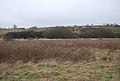
 Towards Gilston - geograph.org.uk - 2801873.jpg 640 × 459; 81 KB
-
 Tree tunnel - geograph.org.uk - 3539457.jpg 640 × 430; 82 KB
-
 View east from Golden Hill - geograph.org.uk - 3895100.jpg 640 × 480; 119 KB
-
 View north across a wheat field - geograph.org.uk - 4594874.jpg 640 × 480; 134 KB
-
 Woodland stream - geograph.org.uk - 3539472.jpg 640 × 430; 123 KB


_Station_-_geograph.org.uk_-_1951296.jpg)


