Category:Gestelnburg
Jump to navigation
Jump to search
| Object location | | View all coordinates using: OpenStreetMap |
|---|
|
This is a category about a cultural property of national significance in Switzerland with KGS number 6903
|
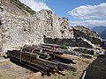
castle in ruins in Niedergesteln in the canton of Valais, Switzerland  | |||||
| Upload media | |||||
| Instance of | |||||
|---|---|---|---|---|---|
| Part of | |||||
| Location | Niedergesteln, Westlich Raron District, Valais, Switzerland | ||||
| Heritage designation | |||||
 | |||||
Media in category "Gestelnburg"
The following 44 files are in this category, out of 44 total.
-
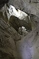
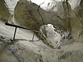
 Feschtiloch 1.jpg 4,896 × 3,672; 6.4 MB
-
 Feschtiloch.jpg 3,672 × 4,896; 5.28 MB
-
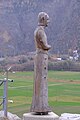 Gestelnburg - Anton I.jpg 4,160 × 6,240; 11.33 MB
-
 Gestelnburg - Aymo I.jpg 4,160 × 6,240; 16.78 MB
-
 Gestelnburg - Aymo III.jpg 4,160 × 6,240; 16.54 MB
-
 Gestelnburg - bâtiment principal (1).jpg 6,240 × 4,160; 16.46 MB
-
 Gestelnburg - bâtiment principal (3).jpg 6,240 × 4,160; 13.97 MB
-
 Gestelnburg - bâtiment principal.jpg 6,240 × 4,160; 13.38 MB
-
 Gestelnburg - citerne.jpg 6,240 × 4,160; 14.05 MB
-
 Gestelnburg - coupe mur.jpg 6,240 × 4,160; 14.03 MB
-
 Gestelnburg - entrée de Feschtiloch.jpg 6,240 × 4,160; 14.13 MB
-
 Gestelnburg - Feschtiloch (1).jpg 6,240 × 4,160; 12.47 MB
-
 Gestelnburg - Feschtiloch (2).jpg 6,240 × 4,160; 10.46 MB
-
 Gestelnburg - Feschtiloch (3).jpg 6,240 × 4,160; 10.94 MB
-
 Gestelnburg - Feschtiloch (4).jpg 4,160 × 6,240; 10.75 MB
-
 Gestelnburg - Feschtiloch (5).jpg 6,240 × 4,160; 13.33 MB
-
 Gestelnburg - Feschtiloch (6).jpg 6,240 × 4,160; 15.79 MB
-
 Gestelnburg - fossé.jpg 6,240 × 4,160; 15.58 MB
-
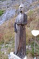
 Gestelnburg - Girold I.jpg 4,160 × 6,240; 15.26 MB
-
 Gestelnburg - Johann I.jpg 4,160 × 6,240; 16.16 MB
-
 Gestelnburg - Peter IV.jpg 4,160 × 6,240; 15.54 MB
-
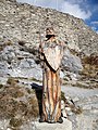
 Gestelnburg - Peter V.jpg 4,160 × 6,240; 14.72 MB
-
 Gestelnburg - sommet de la colline.jpg 6,240 × 4,160; 13.22 MB
-
 Gestelnburg - vieux-village.jpg 6,240 × 4,160; 16.02 MB
-
 Gestelnburg - vue depuis le vieux-village.jpg 6,240 × 4,160; 23.93 MB
-
 Gestelnburg - vue générale.jpg 6,240 × 4,160; 14.01 MB
-
 Gestelnburg - vue vers l'est.jpg 6,240 × 4,160; 14.2 MB
-
 Gestelnburg - vue vers l'ouest.jpg 6,240 × 4,160; 11.45 MB
-
 Gestelnburg - Wilhelm I.jpg 4,160 × 6,240; 15.29 MB
-
 Gestelnburg and church.jpg 6,240 × 3,510; 23.04 MB
-
 Gestelnburg Niedergesteln 01.jpg 3,672 × 4,896; 6.1 MB
-
 Gestelnburg Niedergesteln 02.jpg 4,896 × 3,672; 7 MB
-
 Gestelnburg Niedergesteln 03.jpg 4,896 × 3,672; 5.1 MB
-
 Gestelnburg Niedergesteln 04.jpg 4,896 × 3,672; 5.18 MB
-
 Gestelnburg Niedergesteln 05.jpg 3,672 × 4,896; 5.84 MB
-
 Gestelnburg Niedergesteln 06.jpg 4,896 × 3,672; 4.77 MB
-
 Gestelnburg Niedergesteln 07.jpg 4,896 × 3,672; 4.69 MB
-
 Gestelnburg Niedergesteln 08.jpg 4,896 × 3,672; 7.56 MB
-
 Gestelnburg Niedergesteln 09.jpg 4,896 × 3,672; 6.28 MB
-
 Gestelnburg Niedergesteln 10.jpg 4,896 × 3,672; 6.3 MB
-
 Gestelnburg Niedergesteln 11.jpg 4,896 × 3,672; 7.16 MB
-
 Gestelnburg Niedergesteln 12.jpg 4,896 × 3,672; 6.28 MB
-
 Gestelnburg1.jpg 568 × 426; 64 KB
-
 Niedergesteln-068.jpg 4,896 × 3,672; 6.81 MB


.jpg)
.jpg)


.jpg)
.jpg)
.jpg)
.jpg)
.jpg)
.jpg)


