Category:Germany photographs taken on 2012-09-18
Jump to navigation
Jump to search
| ← | Tuesday 18 September 2012 | → | ||
| ← | September 2012 | → | ||

Germany photographs taken on 18 September 2012.
Image files should be categorized here automatically using {{taken on}} template. Direct categorisation is also possible, if automatic is impossible.
Subcategories
This category has the following 8 subcategories, out of 8 total.
B
L
S
Media in category "Germany photographs taken on 2012-09-18"
The following 98 files are in this category, out of 98 total.
-
 Am Janker-See.jpg 3,264 × 4,912; 2.78 MB
-
 Bad Heilbrunn GO-1.jpg 2,592 × 1,944; 1.67 MB
-
 Bad Kohlgrub from Steigrainer - geo.hlipp.de - 27980.jpg 640 × 427; 94 KB
-
 Bank unter alter Eiche - panoramio.jpg 2,592 × 1,944; 3.48 MB
-
 Below the Rotwandkopf - geo.hlipp.de - 29120.jpg 640 × 427; 86 KB
-
 Below the Rotwandkopf - geo.hlipp.de - 29122.jpg 640 × 427; 127 KB
-
 Berggasthaus Herzogstand - geo.hlipp.de - 27988.jpg 640 × 427; 92 KB
-
 Berggasthaus Herzogstand - geo.hlipp.de - 27990.jpg 493 × 640; 83 KB
-
 Brombachsee 1209 - panoramio.jpg 1,024 × 768; 294 KB
-
 Buchholz im Harz September 12' - panoramio.jpg 3,456 × 2,592; 3.18 MB
-
 Burg Katzenstein 1209 - panoramio.jpg 1,024 × 768; 252 KB
-
 Car park for the Herzogstandbahn - geo.hlipp.de - 27982.jpg 427 × 640; 135 KB
-
 Darß 2013 01.jpg 5,184 × 3,456; 2.48 MB
-
 Descending to the Walchensee - geo.hlipp.de - 29125.jpg 640 × 402; 129 KB
-
 Dinkelsbühl Dr.-Martin-Luther-Straße 6b-c Mühlrad-001.JPG 3,264 × 4,928; 6.77 MB
-
 Dinkelsbühl Spital Einfriedung 8 6b-001.JPG 4,928 × 3,264; 5.86 MB
-
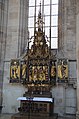 Dinkelsbühl St. Georg Dreifaltigkeitsaltar-001.jpg 3,264 × 4,928; 7.93 MB
-
 Dinkelsbühl St. Georg Dreifaltigkeitsaltar-002.jpg 3,264 × 4,928; 7.47 MB
-
 Dinkelsbühl St. Georg Dreifaltigkeitsaltar-003.jpg 3,264 × 4,928; 7.49 MB
-
 Dinkelsbühl St. Georg Dreifaltigkeitsaltar-004.jpg 4,928 × 3,264; 7.95 MB
-
 Dinkelsbühl St. Georg Dreifaltigkeitsaltar-005.jpg 3,264 × 4,928; 7.85 MB
-
 Dinkelsbühl St. Georg Kreuzaltar-001.jpg 3,264 × 4,928; 8.05 MB
-
 Dinkelsbühl St. Georg Kreuzaltar-002.jpg 4,928 × 3,264; 8.27 MB
-
 Dinkelsbühl St. Georg Kreuzaltar-003.jpg 3,264 × 4,928; 7.53 MB
-
 Dinkelsbühl St. Georg Kreuzaltar-004.jpg 3,264 × 4,928; 7.09 MB
-
 Dinkelsbühl St. Georg Kreuzaltar-005.jpg 3,264 × 4,928; 7.14 MB
-
 Dinkelsbühl St. Georg Kreuzaltar-006.jpg 3,264 × 4,928; 7 MB
-
 Dinkelsbühl St. Georg Kreuzaltar-007.jpg 3,264 × 4,928; 7.14 MB
-
 Dinkelsbühl St. Georg Kreuzaltar-008.JPG 3,264 × 4,928; 8.38 MB
-
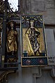
 Dinkelsbühl St. Georg Sebastiansaltar-001.JPG 3,264 × 4,928; 7.14 MB
-
 Dorfkirche Schöneweide - Deutschland - panoramio.jpg 2,592 × 1,944; 2.22 MB
-
 Final ascent to Herzogstand - geo.hlipp.de - 28145.jpg 640 × 427; 112 KB
-
 Flood defences above Walchensee - geo.hlipp.de - 29129.jpg 640 × 427; 123 KB
-
 Flotter Graben bei Schöneweide - panoramio.jpg 2,592 × 1,944; 2.91 MB
-
 Gethsemanekirche Berlin - panoramio.jpg 3,456 × 5,184; 14.1 MB
-
 Gratweg to Heimgarten - geo.hlipp.de - 28154.jpg 640 × 427; 111 KB
-
 Gratweg to Heimgarten - geo.hlipp.de - 28156.jpg 640 × 427; 112 KB
-
 Gratweg to Hertzogstand - geo.hlipp.de - 28157.jpg 640 × 427; 88 KB
-
 Gratweg von Heimgarten - geo.hlipp.de - 28168.jpg 427 × 640; 117 KB
-
 Gratweg, Herzogstand - geo.hlipp.de - 28152.jpg 640 × 427; 110 KB
-
 Gully from the Gratweg - geo.hlipp.de - 28159.jpg 640 × 427; 137 KB
-
 Hamm, Germany - panoramio (2649).jpg 4,896 × 3,672; 3.34 MB
-
 Hamm, Germany - panoramio (2651).jpg 4,896 × 3,672; 2.62 MB
-
 Hamm, Germany - panoramio (2653).jpg 4,896 × 3,672; 2.75 MB
-
 Hamm, Germany - panoramio (2654).jpg 4,896 × 3,672; 2.84 MB
-
 Hamm, Germany - panoramio (2655).jpg 4,896 × 3,672; 2.66 MB
-
 Hamm, Germany - panoramio (2656).jpg 4,896 × 3,672; 1.91 MB
-
 Hamm, Germany - panoramio (2657).jpg 4,896 × 3,672; 2.24 MB
-
 Hamm, Germany - panoramio (2659).jpg 4,896 × 3,672; 3.14 MB
-
 Heimgartengipfel - geo.hlipp.de - 28170.jpg 640 × 427; 90 KB
-
 Herzogstand from the Gratweg - geo.hlipp.de - 28155.jpg 640 × 427; 100 KB
-
 Herzogstandbahn - geo.hlipp.de - 27983.jpg 427 × 640; 100 KB
-
 Herzogstandbahn - geo.hlipp.de - 29131.jpg 427 × 640; 118 KB
-
 Herzogstandbahn - geo.hlipp.de - 29132.jpg 456 × 640; 100 KB
-
 Herzogstandbahn - geo.hlipp.de - 29134.jpg 427 × 640; 92 KB
-
 Kreuzigungsgruppe 1209 - panoramio.jpg 1,024 × 768; 290 KB
-
 Loisach GO-1.jpg 2,592 × 1,944; 1.63 MB
-

-
 Martinskopf - geo.hlipp.de - 28144.jpg 640 × 406; 75 KB
-
 Martinskopf and Herzogstandhaus - geo.hlipp.de - 27986.jpg 640 × 427; 97 KB
-
 Military Advisory Team I-Police Advisory Team II Training Exercise 120918-A-FB952-030.jpg 4,288 × 2,848; 5.75 MB
-
 Military Advisory Team I-Police Advisory Team II Training Exercise 120918-A-FB952-041.jpg 2,848 × 4,288; 5.22 MB
-
 Military Advisory Team I-Police Advisory Team II Training Exercise 120918-A-GG082-014.jpg 3,216 × 2,136; 3.83 MB
-
 Military Advisory Team I-Police Advisory Team II Training Exercise 120918-A-GG082-072.jpg 2,136 × 3,216; 3.13 MB
-
 Mockup of Frecciarossa 1000 on InnoTrans 2012.jpg 2,048 × 1,366; 2.56 MB
-
 Muncipal coat of arm Essen-Kettwig.jpg 1,692 × 951; 765 KB
-
 Murnau Mariensaeule D-1-80-124-107 01.jpg 2,351 × 3,550; 5.56 MB
-
 Murnau Mariensaeule D-1-80-124-107 02.jpg 4,461 × 2,955; 10.29 MB
-

-
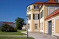
 München - Schloss Nymphenburg - Porzellan-Manufaktur, Hauptgebäude 001.jpg 3,008 × 2,000; 4.12 MB
-
 München - Schloss Nymphenburg - Porzellan-Manufaktur, Hauptgebäude 002.jpg 3,008 × 2,000; 4.12 MB
-
 Neubau von drei Windkraftanlage mit je 3 Megawatt - panoramio.jpg 3,264 × 2,448; 1.58 MB
-
-
 On the descent from Heimgarten - geo.hlipp.de - 28178.jpg 640 × 427; 114 KB
-
 Ortseingang Scharfenbrück - panoramio.jpg 2,592 × 1,944; 1.79 MB
-
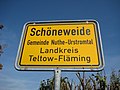 Ortseingang Schöneweide - panoramio.jpg 2,592 × 1,944; 1.67 MB
-
 Path from Bergstation to Herzogstandhaus - geo.hlipp.de - 27985.jpg 640 × 374; 95 KB
-
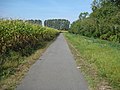 Radweg Gottow -Scharfenbrück bei Schöneweide - panoramio.jpg 2,592 × 1,944; 2.35 MB
-
 Reitweg to Herzogstandhaus - geo.hlipp.de - 27987.jpg 640 × 427; 108 KB
-
 Rocks north of Heimgarten - geo.hlipp.de - 28160.jpg 640 × 400; 95 KB
-
 Schloss Nymphenburg Münich.jpg 3,008 × 2,000; 4.9 MB
-
 Start of Heimgarten descent - geo.hlipp.de - 28174.jpg 427 × 640; 119 KB
-
 Statue of King Ludwig II - geo.hlipp.de - 27989.jpg 427 × 640; 134 KB
-
 The descent from Heimgarten - geo.hlipp.de - 29118.jpg 427 × 640; 117 KB
-
 US Army Europe Expert Field Medical Badge 2012 120918-A-BS310-039.jpg 4,256 × 2,832; 9.03 MB
-
 US Army Europe Expert Field Medical Badge 2012 120918-A-BS310-194.jpg 4,224 × 2,811; 8.09 MB
-
 US Army Europe Expert Field Medical Badge 2012 120918-A-BS310-206.jpg 3,813 × 2,537; 5.85 MB
-
 View from the Bergstation - geo.hlipp.de - 27984.jpg 427 × 640; 115 KB
-
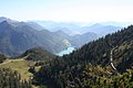
 View from the Gratweg - geo.hlipp.de - 28153.jpg 640 × 427; 94 KB
-
 View from the Gratweg - geo.hlipp.de - 28158.jpg 640 × 427; 83 KB
-
 Waldweg - bei Prevorst - geo.hlipp.de - 27681.jpg 480 × 640; 128 KB
-
 Waldweg - bei Prevorst - geo.hlipp.de - 27682.jpg 480 × 640; 129 KB
-
 Waterfall near Walchensee - geo.hlipp.de - 29127.jpg 427 × 640; 137 KB
-
 Weggabelung - bei Prevorst - geo.hlipp.de - 27680.jpg 640 × 480; 126 KB
-
 Weirs above Walchensee - geo.hlipp.de - 29128.jpg 427 × 640; 133 KB
-
 Windkraftanlage Neubau 2012 3 Megawatt Benhausen u. Neuenbeken - panoramio.jpg 3,264 × 2,448; 1.59 MB
-
 Windkraftanlage Neubau 2012 3 Megawatt Neuenbeken u. Benhausen - panoramio.jpg 2,448 × 3,264; 1.51 MB
-
 Windräder Heng bei Neuenbeken - panoramio.jpg 3,264 × 2,448; 2 MB


.jpg)
.jpg)
.jpg)
.jpg)
.jpg)
.jpg)
.jpg)
.jpg)


_-_Botanischer_Garten_-_Tropenhaus_-_Flickr_-_Pixelteufel.jpg)