Category:Germany photographs taken on 2012-07-05
Jump to navigation
Jump to search

Subcategories
This category has the following 10 subcategories, out of 10 total.
B
M
N
R
Media in category "Germany photographs taken on 2012-07-05"
The following 79 files are in this category, out of 79 total.
-
 94089 Neureichenau, Germany - panoramio.jpg 4,000 × 3,000; 5.2 MB
-

-
 Bad Säckingen - Gebäude Steinbrückstr. 19 (grün) 2012.JPG 2,736 × 3,648; 2.91 MB
-
 Bad Säckingen - Gebäude Steinbrückstr. 19 (Trompeter) 2012.JPG 2,736 × 3,648; 2.26 MB
-
 Bad Säckingen — Alte Wohnhäuser in Rheinnähe (beim Münster.JPG 2,736 × 3,648; 3.05 MB
-
 Bad Säckingen — Alter Hof.JPG 2,736 × 3,648; 3.32 MB
-
 Bad Säckingen — Fischergasse.JPG 2,736 × 3,648; 2.93 MB
-
 Bad Säckingen — Gebäude am Rhein.JPG 3,648 × 2,736; 3.62 MB
-
 Bad Säckingen — Gebäude beim Münster.JPG 3,648 × 2,736; 3.66 MB
-
 Bad Säckingen — Gebäude, Rathausplatz?.JPG 2,736 × 3,648; 3.26 MB
-
 Bad Säckingen — Geschäftszentrum "In der Lohgerbe" — Auffahrt.JPG 3,648 × 2,736; 4.11 MB
-
 Bad Säckingen — Hauensteinstraße 7 (Straßenecke).JPG 3,648 × 2,736; 3.64 MB
-
 Bad Säckingen — Hauensteinstraße 7.JPG 3,648 × 2,736; 3.71 MB
-
 Bad Säckingen — Hochwassermarken.JPG 2,736 × 3,648; 3.54 MB
-
 Bad Säckingen — Pfarrhof vorne.JPG 3,648 × 2,736; 3.63 MB
-
 Bad Säckingen — Scheffelstraße 35.JPG 3,648 × 2,736; 3.61 MB
-

-
 Bad Säckingen — Schönaugasse 3 ohne Fahrzeug.JPG 3,648 × 2,736; 3.85 MB
-
 Bad Säckingen — Speed bumps.JPG 3,648 × 2,736; 4.18 MB
-
 Bad Säckingen — Tafel Rheinbadstraße.JPG 3,648 × 2,736; 3.62 MB
-
 Bad Säckingen, Holzbrücke - Wasserdurchsatzanzeige 2012.JPG 2,736 × 3,648; 3.56 MB
-
 Bad Säckingen, Rathaus — Wappen-Mosaik.JPG 2,533 × 3,477; 2.19 MB
-
 Bad Säckingen, Schlosspark - Kakteengarten 2012.JPG 3,648 × 2,736; 4.25 MB
-
 Biergarten Roggenkönig Petkus - Fläming-Skate RK1 - panoramio.jpg 2,592 × 1,944; 2.53 MB
-
 Blick auf Schloss Blutenburg - geo.hlipp.de - 25771.jpg 640 × 480; 69 KB
-
 Buddhistische Fahnen - panoramio.jpg 1,472 × 1,372; 422 KB
-
 Bücherwagen vor dem Rathaus - panoramio.jpg 1,257 × 1,218; 279 KB
-
 Dahmeradweg - Märkische Idylle (Kiefern und Sand) bei Friedrichshof - panoramio.jpg 2,592 × 1,944; 2.63 MB
-
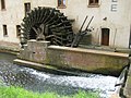 Dammühle (Wassermühle) in Wildau-Wentdorf - panoramio.jpg 2,592 × 1,944; 2.44 MB
-
 Dammühle in Wildau-Wentdorf - panoramio.jpg 2,592 × 1,944; 1.82 MB
-
 Ententeich am Seebach - panoramio.jpg 1,202 × 1,142; 306 KB
-
 Fachwerk in Mühlheim - panoramio.jpg 1,494 × 1,383; 421 KB
-
 Feld bei Olching - geo.hlipp.de - 25764.jpg 640 × 480; 60 KB
-
 Fläming Skate RK 1 - Rastplatz bei Ließen - panoramio.jpg 2,592 × 1,944; 2.92 MB
-
 Fläming Skate Rundkurs 1 in Ließen - panoramio.jpg 2,592 × 1,944; 2.02 MB
-
 Fläming-Skate Strecke S13 zwischen Wahlsdorf und Görsdorf - panoramio.jpg 2,592 × 1,944; 1.88 MB
-
 Herberge Hoher Golm Ließen - am Fläming-Skate Rundkurs1 - panoramio.jpg 2,592 × 1,944; 2.44 MB
-
 Holzbrücke Bad Säckingen (deutsche Seite) — Schild, weiß auf blau, RKS 6 III.jpg 2,736 × 3,648; 3.48 MB
-
 Holzbrücke Bad Säckingen — Alte Grenzplakette D-S.JPG 3,648 × 2,736; 2.87 MB
-
 Katholische Kirche - panoramio (21).jpg 1,626 × 1,515; 469 KB
-
 Kirche in Stülpe - Deutschland - panoramio.jpg 2,592 × 1,944; 1.84 MB
-
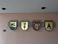 Kommunale Wappen der Stadtgemeinde Bad Säckingen.JPG 3,648 × 2,736; 4.03 MB
-
 Kreuz an der katholischen Kirche - panoramio.jpg 1,610 × 1,457; 529 KB
-
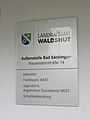 LRA Waldshut Außenstelle Bad Säckingen — Schild.JPG 2,736 × 3,648; 2.74 MB
-
 Mühlheim bei Osthofen - panoramio.jpg 1,596 × 1,534; 490 KB
-
 München-Lochhausen St. Michael 770.jpg 640 × 480; 80 KB
-
 Protestantischer Kirchturm - panoramio.jpg 1,496 × 1,438; 265 KB
-
 Rastplatz am Rundkurs1 zwischen Ließen und Petkus - panoramio.jpg 2,592 × 1,944; 3.11 MB
-
 Rastplatz Dahmeradweg bei Sagritz - panoramio.jpg 2,592 × 1,944; 3 MB
-
 Rastplatz Fläming-Skate Strecke S13 - panoramio.jpg 2,592 × 1,944; 3.17 MB
-
 Reiterhof - panoramio (1).jpg 1,131 × 1,122; 268 KB
-
 Schwefelbach in Mühlheim - panoramio.jpg 1,451 × 1,462; 692 KB
-
 Seebach - panoramio.jpg 1,336 × 1,324; 427 KB
-
 Seebachquelle - panoramio.jpg 1,563 × 1,517; 409 KB
-
 Skaterhotel Petkus am Fläming- Skate RK1 - panoramio.jpg 2,592 × 1,944; 1.77 MB
-
 Sparkasse Alzey-Worms - panoramio.jpg 1,498 × 1,423; 420 KB
-
 Stinkende Schwefelquelle - panoramio.jpg 1,538 × 1,454; 473 KB
-
 Tempo drosseln - scharfe Kurve am Rundkurs1 - panoramio.jpg 2,592 × 1,944; 2.54 MB
-
 Trafostation - Sperenberg - Am See - panoramio.jpg 2,592 × 1,944; 2.07 MB
-
 Trafostation - Sperenberg - Sonnenuntergang - panoramio.jpg 2,592 × 1,944; 1.89 MB
-
 Turm der alten lutherischen Kirche - panoramio.jpg 1,272 × 1,185; 262 KB
-
 Viele Wege führen nach Rom - Rundkursaufteilung in Wahlsdorf - panoramio.jpg 2,592 × 1,944; 2.11 MB
-
 Wegweiser Fläming-Skate Strecke S13 km 2,0 - panoramio.jpg 2,592 × 1,944; 2.49 MB
-
 Wegweiser Fläming-Skate Strecke S7 Km - 5,2 - panoramio.jpg 2,592 × 1,944; 1.94 MB
-
 Wegweiser Fläming-Skate zum aktuellen Standort - panoramio.jpg 2,592 × 1,944; 2.01 MB
-
 Westhofen - panoramio.jpg 1,600 × 1,438; 295 KB
-
 Wieder so ein martialisches Kriegerdenkmal - panoramio.jpg 1,522 × 1,610; 530 KB
-
 Worbis Sommerbergstraße - panoramio (1).jpg 3,456 × 2,592; 5.05 MB
-
 Worbis Sommerbergstraße - panoramio (2).jpg 3,456 × 2,592; 4.21 MB
-
 Worbis Sommerbergstraße - panoramio.jpg 3,456 × 2,592; 6.23 MB
-
 Worbis Straße der Freundschaft - panoramio (1).jpg 3,456 × 2,592; 5 MB
-
 Worbis Straße der Freundschaft - panoramio (3).jpg 3,456 × 2,592; 4.37 MB
-
 Worbis Straße der Freundschaft - panoramio (4).jpg 3,456 × 2,592; 3.83 MB
-
 Worbis Straße der Freundschaft - panoramio (5).jpg 3,456 × 2,592; 5.26 MB
-
 Worbis Straße der Freundschaft - panoramio (6).jpg 3,456 × 2,592; 4.83 MB
-
 Worbis Straße der Freundschaft - panoramio (7).jpg 3,456 × 2,592; 4.37 MB
-
 Worbis Straße der Freundschaft - panoramio.jpg 3,456 × 2,592; 5.03 MB
-
 Worbis Straße der Solidarität - panoramio.jpg 3,456 × 2,592; 4.94 MB
-
 Бремен - panoramio.jpg 3,264 × 2,448; 1.38 MB


_2012.JPG)
_2012.JPG)


.JPG)


_bei_Friedrichshof_-_panoramio.jpg)
_in_Wildau-Wentdorf_-_panoramio.jpg)


_%E2%80%94_Schild,_wei%C3%9F_auf_blau,_RKS_6_III.jpg)

.jpg)


.jpg)


.jpg)
.jpg)

.jpg)
.jpg)
.jpg)
.jpg)
.jpg)
.jpg)


