Category:German-language maps of Texas
Jump to navigation
Jump to search
Media in category "German-language maps of Texas"
The following 5 files are in this category, out of 5 total.
-
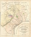
 Adelsverein Karte des Staates Texas 1851 UTA.jpg 3,051 × 2,688; 1.53 MB
-
 Badeker Karte des Staates, Texas 1849 UTA.jpg 3,343 × 2,688; 2.46 MB
-
 Lange Texas 1854 UTA.jpg 4,614 × 3,783; 6.37 MB
-
 Meyer & Radefeld Texas nach den besten Quellen 1846 UTA.jpg 4,450 × 3,779; 6.99 MB
-
 Roemer Topographisch-Geognostiche Karte von Texas 1849 UTA.jpg 5,826 × 6,764; 11.85 MB


