Category:German-language maps of Africa
Jump to navigation
Jump to search
Subcategories
This category has the following 3 subcategories, out of 3 total.
A
N
Media in category "German-language maps of Africa"
The following 106 files are in this category, out of 106 total.
-
 121 of 'Reisen und Jagden in Nord-Ost-Afrika, 1864-1865' (11082024626).jpg 1,543 × 1,980; 429 KB
-
-

-

-

-
 1750 Bellin Map of Cape Town, South Africa - Geographicus - Gundriss-bellin-1750.jpg 3,375 × 2,722; 1.45 MB
-
-
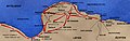
 Heinrich Barth's route through Africa, 1850 to 1855 (Deutsch).jpeg 2,550 × 2,898; 1.26 MB
-
 GRAVIER(1896) p063 Martin Behaim, le Globe de 1492.jpg 2,163 × 1,646; 2.2 MB
-

-
 Abessinien... bearbeitet und - gezeichnet von Osw. Melching - btv1b53058573n.jpg 7,232 × 6,064; 6.47 MB
-
 Africa 1797, Franz Ludwig Güssefeld (4017888-recto) cropped.jpg 1,534 × 1,376; 1.23 MB
-
 Africa 1797, Franz Ludwig Güssefeld (4017888-recto).png 3,751 × 3,174; 19.99 MB
-
 African continent-de.png 2,000 × 1,889; 884 KB
-
 Afrika (Politische Übersicht) - DPLA - 31ad2e0b231bc2ec04b2564815b26b7a.jpg 1,000 × 714; 250 KB
-
 Afrika Karte 1914.svg 1,430 × 1,350; 1.73 MB
-
 Afrika Politisch 2.png 982 × 991; 210 KB
-
 Afrikamapde.png 1,050 × 1,152; 46 KB
-
 Afrique équatoriale - btv1b53146664b (1 of 3).jpg 5,712 × 4,252; 3.94 MB
-
 Afrique équatoriale - btv1b53146664b (2 of 3).jpg 6,012 × 4,898; 4.2 MB
-
 Afrique équatoriale - btv1b53146664b (3 of 3).jpg 4,266 × 5,282; 3.45 MB
-
 Anteil der Mittelschicht in afrikanischen Ländern 2010 - HBS.jpg 1,024 × 683; 215 KB
-
 Areas named karoo.png 1,578 × 1,457; 2.29 MB
-
 Ausbreitung des Menschen.png 1,782 × 1,412; 3.94 MB
-
 Azawad map-german.jpg 660 × 706; 136 KB
-
 Bevölkerungsdichte Nigerischer Bundesstaaten.png 823 × 638; 46 KB
-
 Brit.Somaliland 11 8 2011 023.jpg 791 × 516; 128 KB
-
 Canopus menouthis herakleion-es.jpg 375 × 287; 51 KB
-
 Canopus menouthis herakleion.jpg 375 × 287; 31 KB
-
 Cosmographia (Sebastian Münster) p 120.jpg 2,000 × 1,455; 477 KB
-
 Debes 1888 Afrika.jpg 1,916 × 1,591; 3.12 MB
-
 Die 10 am schnellsten wachsenden Ökonomien Fokus Afrika - HBS.jpg 1,024 × 683; 169 KB
-
 Die westafrikanische Küste von Accra bis Ogowe.png 8,374 × 6,535; 82.66 MB
-
 Egypt under Muhammad Ali Dynasty map de 2.png 1,998 × 2,253; 1.1 MB
-
 Einkommensverteilung in afrikanischen Ländern nach GINI - HBS.jpg 1,024 × 724; 204 KB
-
 Ethnographische Übersicht der Völker des äquatorialen Ost-Afrika von Dr. Franz Stuhlmann.jpg 19,464 × 14,877; 81.44 MB
-
 Fgm map german.gif 320 × 306; 7 KB
-
 General-Karte von Afrika.png 12,512 × 8,390; 162.95 MB
-
 Ghica-Comanesti in Somalia.jpg 2,310 × 3,770; 2.28 MB
-

-
 Kapstaaten 1905.png 1,000 × 1,016; 614 KB
-
 Karte - Schlacht bei Alam Halfa (1942).png 1,088 × 1,564; 519 KB
-
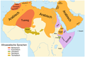 Karte der Afroasiatischen Sprachen.png 1,856 × 1,250; 143 KB
-
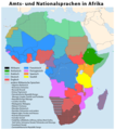 Karte der Amtssprachen und Nationalsprachen in Afrika.png 1,323 × 1,501; 376 KB
-
 Karte Mali.png 3,007 × 3,225; 657 KB
-
 Karte Niger - Nationalsprachen.png 2,095 × 1,586; 515 KB
-
 Karte von Afrika - entworfen von F. Handtke - btv1b53204398k.jpg 10,657 × 8,713; 22.58 MB
-
 Karte von Afrika entworfen und gezeichnet von Albrecht Platt - btv1b53223942c.jpg 11,272 × 8,894; 11.62 MB
-
 Karte von Afrika mit besonderer Berücksichtigung der deutschen Kolonien (1886).png 10,747 × 11,298; 209.23 MB
-
 Karte von Afrika mit besonderer Berücksichtigung der deutschen Kolonien (1900).png 10,553 × 11,170; 193.54 MB
-
 Karte von Afrika nach Berghaus... - bearbeitet von F. Renner... - btv1b53088573k.jpg 8,742 × 7,845; 11.71 MB
-

-
 Karte von Afrika.png 10,657 × 8,713; 177.41 MB
-
 Karte von Süd-Afrika mit besonderer Berücksichtigung der deutschen Kolonien (1900).png 10,417 × 6,015; 99.81 MB
-

-
 Karte Ägyptens.png 330 × 379; 17 KB
-
 Kettler's Ilandkarte von deutsch - Ostafrika - btv1b8440199n (1 of 3).jpg 8,386 × 8,530; 10.38 MB
-
 Landkarten MfM Roboto Slab web uebersicht NEU.jpg 5,001 × 3,334; 1,010 KB
-
 Madagaskarphelsuma.jpg 366 × 599; 51 KB
-
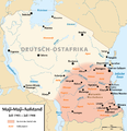 Maji Maji rebellion - de.png 1,446 × 1,496; 228 KB
-
 Map of Southafrica.gif 266 × 268; 20 KB
-
 Marokko. Übersichtskarte - btv1b531213854.jpg 8,426 × 7,922; 9.68 MB
-
 Menschen für Menschen Schweiz in Äthiopien.png 1,862 × 1,470; 617 KB
-
 Mungo Parks Route 1795-97 and 1805-06.png 1,947 × 1,134; 622 KB
-
 National Parks in Namibia de.png 975 × 900; 268 KB
-
 Neueste Karte von Afrika.png 7,748 × 8,660; 130.55 MB
-
 Neuester Karte von Afrika - Ausgeführt in der kartogr. Anstalt von J.Mann - btv1b530277717.jpg 14,560 × 16,274; 41.92 MB
-
 Ng-map (de).png 330 × 355; 9 KB
-
 Niger-Fluss.jpg 818 × 553; 136 KB
-
 Niger-Kongo-Karte.png 1,207 × 1,139; 138 KB
-
 Niger-Kongo-Sprachen.png 1,207 × 1,139; 74 KB
-
 Niger-Kongo-Sprachen1.PNG 1,207 × 1,251; 124 KB
-
 Nigeria-karte-politisch-borno.png 567 × 562; 176 KB
-
 Nigeria-karte-politisch-kano.png 567 × 562; 177 KB
-
 Nigeria-karte-politisch-rivers.png 567 × 562; 167 KB
-
 Nigeria-karte-politisch.png 566 × 480; 163 KB
-
 NigeriaOccidental1907.jpg 985 × 1,214; 914 KB
-
 Originalkarte der Nord-Abessinischen Grenzlande.png 8,588 × 5,351; 62.74 MB
-
 Ottoman Possessions 19th Century.jpg 1,125 × 1,383; 1.61 MB
-
 Richard Kiepert, Deutsche und Britische Schutzgebiete in Aequatorial-Ost-Afrika, 1890.jpg 3,084 × 2,509; 3.45 MB
-
-
 Rohstoffvorkommen auf dem afrikanischen Kontinent 2009 - HBS.jpg 1,024 × 683; 234 KB
-
 Roman Africa.JPG 3,057 × 2,439; 1.95 MB
-
 Second Congo War Africa map de.png 1,525 × 1,440; 418 KB
-
 SolarGIS-Solar-map-Africa-and-Middle-East-de.png 850 × 850; 663 KB
-
 Deutsch-Sudwestafrika.png 524 × 533; 737 KB
-
 Südwestafrika 1915.jpg 1,193 × 1,351; 160 KB
-
 Umgegend von Algier (Al Djezair).jpg 6,800 × 7,737; 8.05 MB
-
 VorstoßDAK.jpg 800 × 252; 66 KB
-
 Wachstumsraten der afrikanischen Länder 2001-2012 - HBS.jpg 1,024 × 683; 207 KB
-
 Westermanns Neuer Schulatlas 1928 (28) Afrika, Gelände.jpg 4,546 × 6,644; 10.99 MB
-
-
 Wirtschaftliche Leistungsfähigkeit der afrikanischen Ökonomien - HBS.jpg 1,024 × 683; 232 KB
-
 Woermann-Linie. Deutsche Ost-Afrika Line.jpg 19,030 × 23,684; 161.42 MB
-
 Zentralafrikanische-republik-karte-politisch-ombella-mpoko.png 425 × 596; 165 KB
-
 Andree Übersichstkarte von Afrika 1893 UTA.jpg 6,128 × 4,903; 9.57 MB
-
 Andree Übersichstkarte von Afrika 1899 UTA.jpg 6,260 × 5,031; 8.85 MB
-
 Gussefeld Charte von Africa 1797 UTA.jpg 6,443 × 5,783; 13.88 MB
-
 Henricpetri-Münster, Affricae Tabula Nova-Africa, Lybia Dozenlandt 1580 UTA.jpg 4,568 × 4,025; 8.33 MB
-
 Mallet Afrique Ancienne 1719 UTA.jpg 1,469 × 2,009; 1.24 MB
-
 Münster Algiers 1550 UTA.jpg 2,182 × 1,796; 3.76 MB
-
 Schreiber Africa 1730 UTA.jpg 2,912 × 2,054; 2.76 MB
-
 Walch Afrika 1812 UTA.jpg 2,710 × 2,299; 2.45 MB
-
 Zimmermann & Grunsting Die Kusten Lander von Ober- u. Nieder-Guinea 1802 UTA.jpg 2,839 × 2,650; 3.56 MB
-
 Übersichtskarte von Afrika 1886 UTA.jpg 6,148 × 4,935; 10.95 MB
-
 Übersichtskarte von DSWA.png 1,248 × 1,212; 1.56 MB
.jpg)
.jpg)
.jpg)

.jpg)


.jpeg)
_p063_Martin_Behaim,_le_Globe_de_1492.jpg)

_cropped.jpg)
.png)

_-_DPLA_-_31ad2e0b231bc2ec04b2564815b26b7a.jpg)


.jpg)
.jpg)
.jpg)


_p_120.jpg)


.png)


.png)
.png)


.png)


.jpg)


.png)


.jpg)

_Afrika,_Gel%C3%A4nde.jpg)
_Ehemalige_Deutsche_Schutzgebiete,_Staaten_und_Exporte.jpg)


.jpg)