Category:German-language map legends
Jump to navigation
Jump to search
Media in category "German-language map legends"
The following 34 files are in this category, out of 34 total.
-
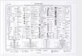
 Abkürzungsverzeichnis, Zeichenschlüssel der GKM.jpg 5,581 × 7,898; 6.16 MB
-
 Abkürzungsverzeichnis, Zeichenschlüssel der Spezialkarte.jpg 8,268 × 5,656; 6.18 MB
-
 Armenian population map 1896 Erklärungen.jpg 362 × 351; 54 KB
-
 Barbados-2011.PNG 941 × 1,205; 879 KB
-
 Barbados-karte.png 941 × 1,205; 739 KB
-
 Charte von Schwaben Anleitung.jpg 2,133 × 2,634; 3.71 MB
-
 Dreidimensionale Klimakarte Deutschlands Legende.gif 3,000 × 2,400; 458 KB
-
 Dreidimensionale Klimakarte Deutschlands Legende.png 3,000 × 2,400; 614 KB
-
 Dreidimensionale Klimakarte Deutschlands Legende.svg 512 × 410; 9 KB
-
 Dürre 2018 Deutschland Kartenlegende.png 1,232 × 187; 35 KB
-
 Ethnographische Übersichtskarte des ukrainischen Nationalterritoriums (1910) - Legend.jpg 9,749 × 6,072; 6.02 MB
-
 EU location legend.png 745 × 400; 17 KB
-

-
 Herrschaftskarte Kisslegg 12.jpg 2,900 × 2,792; 3.78 MB
-
 Herrschaftskarte Kisslegg 14.jpg 3,445 × 2,244; 3.42 MB
-
 Karte des Deutschen Reiches (5820730).jpg 13,485 × 11,517; 71.17 MB
-
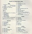
 Kartenzeichen.jpg 393 × 879; 124 KB
-
 Königsberg, Skizze der Befestigungen im 16. Jahrhundert nach C. Beckherrn, Legende.jpg 1,820 × 1,971; 2.41 MB
-
 Legend for Franciscan Cadastral Maps (1824).PDF 2,479 × 1,752; 18.76 MB
-
 Legend for Franciscan Cadastral Maps 1824 (2).jpg 1,752 × 2,502; 711 KB
-
 Legend for Franciscan Cadastral Maps 1824.jpg 5,409 × 4,075; 3.52 MB
-
 Legend for Franciscan Cadastral maps 1912 (part).jpg 2,248 × 4,000; 1.91 MB
-
 Legende Karte Gemeindegrenzen.PNG 657 × 148; 6 KB
-
 Legende LK Fürth.svg 263 × 640; 18 KB
-
 Legende uraufnahme.pdf 1,239 × 1,754, 4 pages; 3.63 MB
-
 Maßstabsleiste.png 697 × 397; 24 KB
-
 Messtischblatt 1933-legende.png 760 × 4,833; 492 KB
-
 Mk Rotterdam Metro Legende.png 700 × 377; 8 KB
-
 Rauch Prospekt Ravensburg und Weißenau 1622 a03.jpg 1,749 × 3,993; 3.21 MB
-
 Saechsische Radfahrer-Zeitung 1902-07-19, p3.jpg 975 × 702; 116 KB
-
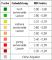 Worldmap-hdi2004-legende.png 250 × 286; 2 KB
-

-
 Zeichenerklärung Uraufnahme.pdf 1,239 × 1,754, 4 pages; 3.58 MB
-
 Zeichenerklärung, Specialkarte der k.u.k. ö-u Monarchie, TK75.jpg 7,108 × 2,748; 1.29 MB


_-_Legend.jpg)


.jpg)


.jpg)

.jpg)


_(cropped).jpg)