Category:Geotopes in Landkreis Regen
Jump to navigation
Jump to search
Urban districts (cities): Aschaffenburg · Bayreuth · Coburg · Fürth · Hof · Kempten · Landshut · Munich · Nuremberg · Passau · Regensburg · Schweinfurt · Weiden in der Oberpfalz · Würzburg
Wikimedia list article | |||||
| Upload media | |||||
| Instance of | |||||
|---|---|---|---|---|---|
| Location |
| ||||
| |||||
Subcategories
This category has the following 27 subcategories, out of 27 total.
A
- Aitnachtal bei Viechtach (2 F)
- Antonius-Pfahl bei Viechtach (6 F)
E
G
H
- Hochfall im Moosbachtal (16 F)
- Höllbachgspreng (21 F)
N
- Naturschutzgebiet Hof-Pfahl (6 F)
P
- Pfahl von Weißenstein (1 F)
R
- Rißlochfälle (Bodenmais) (40 F)
S
- Silberberg Mine (26 F)
- Steinbachfall am Falkenstein (2 F)
Media in category "Geotopes in Landkreis Regen"
The following 13 files are in this category, out of 13 total.
-
 Arberseewand.jpg 4,000 × 3,000; 4.76 MB
-
 Blick über den Großen Arbersee.jpg 4,000 × 3,000; 4.68 MB
-
 Felsklippe, Großer Falkenstein.jpg 4,000 × 3,000; 5.1 MB
-
 Geotop Arber.jpg 4,000 × 3,000; 4.76 MB
-
 Geotop bei Prackenbach.jpg 3,456 × 5,184; 7.72 MB
-
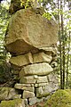
 Geotop Großer Pfahl.jpg 4,000 × 3,000; 4.39 MB
-
 Granitklippen & Blockmeer.jpg 3,456 × 5,184; 10.86 MB
-
 Granitklippen bei der Bärenkapelle.jpg 3,456 × 5,184; 9.56 MB
-
 Granitklippen und Blockmeer.jpg 5,184 × 3,456; 10.16 MB
-
 Großer Arbersee, Bayerischer Wald.jpg 4,000 × 3,000; 4.79 MB
-
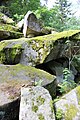
 Keltenschale bei Prackenbach.jpg 5,184 × 3,456; 7.32 MB
-
 Keltenschale.jpg 4,000 × 3,000; 4.43 MB
-
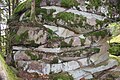
 Wollsackbildung.jpg 3,456 × 5,184; 9.53 MB


