Category:Geotopes in Landkreis Osnabrück
Jump to navigation
Jump to search

Deutsch: Geotope im Landkreis Osnabrück, Niedersachsen – siehe Liste der Geotope im Landkreis Osnabrück
English: Geotopes in Landkreis Osnabrück, Lower Saxony, Germany
Wikimedia list article | |||||
| Upload media | |||||
| Instance of | |||||
|---|---|---|---|---|---|
| Location |
| ||||
| |||||
Subcategories
This category has the following 8 subcategories, out of 8 total.
D
G
- Geotop Erdfall bei Dratum (10 F)
- Großsteingrab Haltern (7 F)
H
- Hasequelle (26 F)
- Helmichsteine (10 F)
N
- Näpfchenstein (Restrup) (7 F)
S
- Süntelstein (6 F)
Media in category "Geotopes in Landkreis Osnabrück"
The following 7 files are in this category, out of 7 total.
-
 Diskordanz Hüggel.jpg 4,320 × 3,240; 3.99 MB
-
 Einschnitt Hüggelbahn.jpg 4,320 × 3,240; 4.78 MB
-
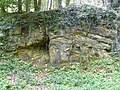
 Grafentafel.jpg 3,264 × 2,448; 4.59 MB
-
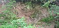
 Icker Loch Belm.jpg 1,600 × 1,200; 683 KB
-
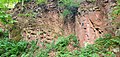 Roter Buntsandsteinbruch 1.jpg 4,032 × 1,908; 4.4 MB
-
 Roter Buntsandsteinbruch 2.jpg 4,032 × 1,908; 4.17 MB
-
 Roter Buntsandsteinbruch 3.jpg 4,032 × 1,908; 4.41 MB


