Category:Geothermal energy maps of Germany
Jump to navigation
Jump to search
Media in category "Geothermal energy maps of Germany"
The following 75 files are in this category, out of 75 total.
-
Altenbeken geothermische Karte.png 800 × 837; 55 KB
-
Augustdorf geothermische Karte.png 800 × 700; 46 KB
-
Bad Driburg geothermische Karte.png 600 × 700; 62 KB
-
Bad Lippspringe geothermische Karte.png 940 × 680; 315 KB
-
Bad Oeynhausen geothermische Karte.png 800 × 900; 67 KB
-
Bad Salzuflen geothermische Karte.png 1,000 × 900; 110 KB
-
Bad Wünnenberg geothermische Karte.png 779 × 615; 138 KB
-
Barntrup geothermische Karte.png 800 × 700; 58 KB
-
Beverungen geothermische Karte.png 900 × 930; 77 KB
-
Blomberg geothermische Karte.png 1,150 × 815; 78 KB
-
Borchen geothermische Karte.png 1,081 × 853; 51 KB
-
Borgentreich geothermische Karte.png 650 × 630; 45 KB
-
Borgholzhausen - Geothermal Yield.svg 495 × 331; 187 KB
-
Borgholzhausen geothermische Karte.png 815 × 650; 51 KB
-
Brakel geothermische Karte.png 700 × 700; 56 KB
-
Bünde geothermische Karte.png 750 × 800; 53 KB
-
Büren geothermische Karte.png 865 × 683; 114 KB
-
Delbrück geothermische Karte.png 975 × 802; 58 KB
-
Detmold geothermische Karte.png 700 × 600; 60 KB
-
Dörentrup geothermische Karte.png 820 × 600; 45 KB
-
Enger geothermische Karte.png 800 × 600; 41 KB
-
Espelkamp geothermische Karte.png 950 × 700; 50 KB
-
Extertal geothermische Karte.png 1,000 × 820; 66 KB
-
Geothermie peckeloh.png 1,000 × 670; 75 KB
-
Geothermische Standorte.gif 1,000 × 665; 124 KB
-
Gütersloh geothermische Karte.png 1,081 × 906; 62 KB
-
Halle - Geothermal Yield.svg 470 × 362; 376 KB
-
Halle geothermische Karte.png 820 × 800; 61 KB
-
Harsewinkel geothermische Karte.png 657 × 414; 43 KB
-
Herford geothermische Karte.png 900 × 880; 70 KB
-
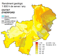
Herford mapa geotèrmica.PNG 900 × 880; 68 KB
-
Herzebrock-Clarholz geothermische Karte.png 570 × 480; 37 KB
-
Hiddenhausen geothermische Karte.png 680 × 530; 36 KB
-
Hille geothermische Karte.png 600 × 620; 41 KB
-
Horn-Bad Meinberg geothermische Karte.png 700 × 600; 51 KB
-
Hövelhof geothermische Karte.png 872 × 614; 43 KB
-
Höxter geothermische Karte.png 600 × 760; 53 KB
-
Hüllhorst geothermische Karte.png 900 × 600; 39 KB
-
Kalletal geothermische Karte.png 630 × 600; 59 KB
-
Kirchlengern geothermische Karte.png 750 × 700; 41 KB
-
Lage (Lippe) geothermische Karte.png 810 × 880; 80 KB
-
Langenberg geothermische Karte.png 650 × 597; 21 KB
-
Lemgo geothermische Karte.png 600 × 650; 49 KB
-
Leopoldshöhe geothermische Karte.png 700 × 680; 44 KB
-
Lichtenau geothermische Karte.png 800 × 611; 176 KB
-
Löhne geothermische Karte.png 700 × 800; 50 KB
-
Lübbecke geothermische Karte.png 900 × 650; 49 KB
-
Lügde geothermische Karte.png 500 × 730; 48 KB
-
Marienmünster geothermische Karte.png 800 × 780; 60 KB
-
Minden geothermische Karte.png 1,000 × 900; 80 KB
-
Nieheim geothermische Karte.png 884 × 771; 83 KB
-
Oerlinghausen geothermische Karte.png 800 × 600; 47 KB
-
Paderborn geothermische Karte.png 880 × 678; 276 KB
-
Petershagen geothermische Karte.png 836 × 695; 56 KB
-
Porta Westfalica geothermische Karte.png 1,100 × 750; 73 KB
-
Preußisch Oldendorf geothermische Karte.png 800 × 800; 55 KB
-
Rahden geothermische Karte.png 700 × 650; 42 KB
-
Rheda-Wiedenbrück geothermische Karte.png 600 × 580; 32 KB
-
Rietberg geothermische Karte.png 577 × 596; 42 KB
-
Rödinghausen geothermische Karte.png 700 × 650; 35 KB
-
Salzkotten geothermische Karte.png 904 × 633; 144 KB
-
Schieder-Schwalenberg geothermische Karte.png 700 × 580; 49 KB
-
Schlangen geothermische Karte.png 850 × 700; 69 KB
-
Schloss Holte-Stukenbrock geothermische Karte.png 580 × 450; 40 KB
-
Spenge geothermische Karte.png 740 × 670; 40 KB
-
Spenge geothermische Karte.svg 837 × 714; 197 KB
-
Steinhagen geothermische Karte.png 770 × 630; 48 KB
-
Steinheim geothermische Karte.png 650 × 580; 47 KB
-
Stemwede geothermische Karte.png 700 × 700; 40 KB
-
Verl geothermische Karte.png 745 × 610; 146 KB
-
Versmold geothermische Karte.png 1,000 × 670; 49 KB
-
Vlotho geothermische Karte.png 1,050 × 704; 100 KB
-
Warburg geothermische Karte.png 872 × 600; 63 KB
-
Werther geothermische Karte.png 760 × 597; 49 KB
-
Willebadessen geothermische Karte.png 740 × 550; 53 KB


