Category:Geospatial SQL Server
Jump to navigation
Jump to search
Media in category "Geospatial SQL Server"
The following 8 files are in this category, out of 8 total.
-
 GeospatialSQLServer2008 SpatialDataTypes Diagram.jpg 677 × 275; 30 KB
-
 GeospatialSQLServer2008 SpatialDataTypes GeometryCollection.JPG 171 × 185; 5 KB
-
 GeospatialSQLServer2008 SpatialDataTypes LineString.JPG 171 × 185; 2 KB
-
 GeospatialSQLServer2008 SpatialDataTypes MultiLineString.JPG 171 × 185; 3 KB
-
 GeospatialSQLServer2008 SpatialDataTypes MultiPoint.JPG 171 × 185; 2 KB
-
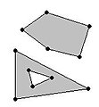 GeospatialSQLServer2008 SpatialDataTypes MultiPolygon.JPG 171 × 185; 5 KB
-
 GeospatialSQLServer2008 SpatialDataTypes Point.jpg 171 × 185; 1 KB
-
 GeospatialSQLServer2008 SpatialDataTypes Polygon.JPG 171 × 185; 3 KB


