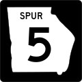
Category:Georgia State Route 5
Jump to navigation
Jump to search
 | number: | (five) |
|---|---|---|
| State highways in Georgia (U.S. state): | 1 · 2 · 3 · 4 · 5 · 6 · 7 · 8 · 9 · 10 · 11 · 12 · 13 · 14 · 15 · 16 · 17 · 18 · 19 · 20 · 21 · 22 · 23 · 24 · 25 |
State highway in northern Georgia | |||||
| Upload media | |||||
| Instance of | |||||
|---|---|---|---|---|---|
| Location | Georgia | ||||
| Transport network | |||||
| Owned by | |||||
| Maintained by | |||||
| Inception |
| ||||
| Length |
| ||||
| |||||
English: State Route 5 (SR 5) is a route that bisects northern Georgia. It passes through the county seats of Blue Ridge, Ellijay, Jasper, Canton, Marietta, and Douglasville. Along the way, it overlaps one of metro Atlanta's freeways, I-575. From the Cherokee/Pickens County line to Blue Ridge, Georgia 5 is cosigned with SR 515. It also shares routing with US 76 from Ellijay to Blue Ridge. This route parallels the Marietta and North Georgia Rail Line.
Subcategories
This category has only the following subcategory.
Media in category "Georgia State Route 5"
The following 13 files are in this category, out of 13 total.
-
Georgia 5 Alternate.svg 600 × 600; 6 KB
-
Georgia 5 Business.svg 600 × 600; 8 KB
-
Georgia 5 Bypass.svg 600 × 600; 8 KB
-
Georgia 5 Spur.svg 600 × 600; 9 KB
-
Downtown Austell, Georgia.JPG 3,456 × 2,304; 4.44 MB
-
GA SR 5 in Keithsburg, June 2017 1.jpg 3,456 × 2,304; 3.86 MB
-
GA SR 5 in Keithsburg, June 2017 2.jpg 3,456 × 2,304; 4.51 MB
-
Georgia 5.svg 600 × 600; 4 KB
-
Georgia Route 5 in McCaysville.JPG 3,456 × 2,304; 4.2 MB
-
Georgia State Route 5 in Douglas County.JPG 2,592 × 1,944; 2.33 MB
-
Georgia state route 5 map.png 1,092 × 741; 290 KB
-
Georgia State Routes 5 and 515 at overlook.jpg 2,032 × 1,524; 601 KB
-
Georgia5and120loop.jpg 2,032 × 1,524; 784 KB


