Category:Georgia State Route 27
Jump to navigation
Jump to search
 | number: | (twenty-seven) |
|---|---|---|
| State highways in Georgia (U.S. state): | 7 · 8 · 9 · 10 · 11 · 12 · 13 · 14 · 15 · 16 · 17 · 18 · 19 · 20 · 21 · 22 · 23 · 24 · 25 · 26 · 27 · 28 · 29 · 30 · 31 · 32 · 33 · 34 · 35 · 36 · 37 · 38 · 39 · 40 · 41 · 42 · 43 · 44 · 45 · 46 · 47 |
State highway in southern Georgia  | |||||
| Upload media | |||||
| Instance of | |||||
|---|---|---|---|---|---|
| Location | Georgia | ||||
| Transport network | |||||
| Owned by | |||||
| Maintained by | |||||
| Inception |
| ||||
| Length |
| ||||
| |||||
English: Media related to Georgia State Route 27, a state highway that runs west-to-east through portions of Quitman, Stewart, Webster, Sumter, Dooly, Pulaski, Dodge, Telfair, Jeff Davis, Appling, Wayne, and Glynn counties in the southern part of Georgia, United States, crossing nearly the entire state from Georgetown, just east of the Alabama state line to Brunswick, just west of the Atlantic coast.
Subcategories
This category has the following 3 subcategories, out of 3 total.
G
Media in category "Georgia State Route 27"
The following 35 files are in this category, out of 35 total.
-
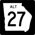 Georgia 27 Alternate.svg 600 × 600; 7 KB
-
 Georgia 27 Loop.svg 600 × 600; 12 KB
-
 Georgia 27 Spur.svg 600 × 600; 12 KB
-
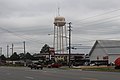 Baxley Water Tower US341.jpg 5,184 × 3,456; 5.33 MB
-
 Dodge County, US341WB.JPG 4,608 × 3,456; 5.71 MB
-
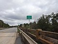 Dooly County border, GA27EB.JPG 4,608 × 3,456; 4.49 MB
-
 GA 215 end, Vienna.jpg 5,184 × 3,456; 9.99 MB
-
 GA27-87 Int NB, Eastman.JPG 4,608 × 3,456; 4.87 MB
-
 GA27-87 Int SB, Eastman.JPG 4,608 × 3,456; 3.95 MB
-
 Georgia 27 Business.svg 600 × 600; 10 KB
-
 Georgia 27.svg 600 × 600; 5 KB
-
 Georgia I75sb GA27 overpass.jpg 5,184 × 3,456; 4.16 MB
-
 Georgia I75sb GA27.jpg 5,184 × 3,456; 4.28 MB
-
 Georgia state route 27 map.png 1,593 × 786; 350 KB
-
 Jeff Davis County limit US341SB.jpg 5,184 × 3,456; 6.01 MB
-
 KFC, US341, Dock Junction.JPG 4,608 × 3,456; 3.89 MB
-
 Krystal, Dock Junction.JPG 4,608 × 3,456; 4.68 MB
-
 Lumber City city limit US341NB.jpg 5,184 × 3,456; 7.88 MB
-
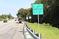
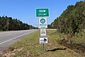 Odum limit, US341 GA27WB.jpg 5,184 × 3,456; 9.56 MB
-
 Odum railroad sign.jpg 5,184 × 3,456; 9.18 MB
-
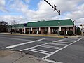 PNC Bank, Vienna.JPG 4,608 × 3,456; 5.15 MB
-
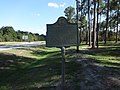 Talmadge Home Historical marker.JPG 4,608 × 3,456; 5.49 MB
-
 Telfair County Courthouse.JPG 4,608 × 3,456; 5.82 MB
-
 Telfair County Elementary School.JPG 4,608 × 3,456; 5.2 MB
-
 Telfair County limit US341NB.jpg 5,184 × 3,456; 7.78 MB
-
 U.S. 341 RR Crossing WB, Helena.JPG 4,608 × 3,456; 4.76 MB
-
 US280+US19+GA3+GA27+GA30+GA49TwoAssemblies-Americus (22830101638).jpg 2,400 × 1,600; 1.96 MB
-
 US341 and railroad bridge over Ocmulgee River.jpg 5,184 × 3,456; 6.47 MB
-
 US341SB over Ocmulgee River.jpg 5,184 × 3,456; 5.52 MB
-
 US341sUS23sGA27sRoadSigns (32094464423).jpg 2,400 × 1,600; 1.75 MB
-
 Vienna City limit, GA27EB.JPG 4,608 × 3,456; 4.79 MB
-

-

-

-


.jpg)


.jpg)

Categories:
- State highways in Georgia (U.S. state) by number
- Roads numbered 27
- Roads in Appling County, Georgia
- Roads in Quitman County, Georgia
- Roads in Stewart County, Georgia
- Roads in Telfair County, Georgia
- Roads in Webster County, Georgia
- Roads in Sumter County, Georgia
- Roads in Dooly County, Georgia
- Roads in Pulaski County, Georgia
- Roads in Jeff Davis County, Georgia
- Roads in Wayne County, Georgia
- Roads in Glynn County, Georgia
- Roads in Dodge County, Georgia