Category:Geology of the Isle of Man
Appearance
Wikimedia category | |||||
| Upload media | |||||
| Instance of | |||||
|---|---|---|---|---|---|
| Category combines topics | |||||
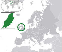
| Isle of Man | |||||
historic nation and a self-governing British Crown dependency | |||||
| Instance of | |||||
| Part of |
| ||||
| Patron saint |
| ||||
| Location | Irish Sea | ||||
| Capital | |||||
| Legislative body | |||||
| Executive body | |||||
| Official language | |||||
| Anthem | |||||
| Currency | |||||
| Head of state |
| ||||
| Head of government |
| ||||
| Inception |
| ||||
| Highest point | |||||
| Population |
| ||||
| Area |
| ||||
| Top-level Internet domain | |||||
| Different from | |||||
| official website | |||||
 | |||||
| Isle of Man | |||
|---|---|---|---|
| |||
Subcategories
This category has the following 6 subcategories, out of 6 total.
Media in category "Geology of the Isle of Man"
The following 11 files are in this category, out of 11 total.
-
Anticline, Dhoon Beach, Isle of Man - geograph.org.uk - 377593.jpg 640 × 493; 98 KB
-
Colonial Coral Fossil in Arbory on Isle of Man - geograph 7507972.jpg 1,024 × 731; 1,020 KB
-
Glen Maye, beach, evening sunlight - geograph.org.uk - 777849.jpg 640 × 480; 123 KB
-
Iapetus Suture - Niarbyl Fault - Isle of Man - kingsley - 23-JUN-09.jpg 2,560 × 1,920; 1.08 MB
-
Laxey - The Mines Trail - Sign at The Old Adit entrance - geograph.org.uk - 1707231.jpg 3,198 × 2,132; 2.77 MB
-
Rock Outcrop on Maughold Head - geograph.org.uk - 777740.jpg 640 × 480; 149 KB
-
Rocks on beach, Glen Maye - geograph.org.uk - 773591.jpg 640 × 480; 125 KB
-
Rocks on beach, Glen Maye - geograph.org.uk - 773599.jpg 640 × 480; 128 KB
-
Rocks on beach, Glen Maye - geograph.org.uk - 773604.jpg 480 × 640; 149 KB
-
Geological fault at Niarbyl - geograph.org.uk - 107854.jpg 640 × 480; 88 KB


