Category:Geological maps of Préchac (Hautes-Pyrénées)
Jump to navigation
Jump to search
Media in category "Geological maps of Préchac (Hautes-Pyrénées)"
The following 8 files are in this category, out of 8 total.
-
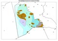
 65371-Préchac-argile.jpg 3,057 × 2,480; 424 KB
-
 65371-Préchac-Géologie-Leg.pdf 2,481 × 1,754, 3 pages; 7.52 MB
-
 65371-Préchac-Géologie.png 7,015 × 4,960; 4.03 MB
-
 65001-Adast-Géologie.png 7,015 × 4,960; 4.6 MB
-
 65025-Argelès-Gazost-Géologie.png 7,015 × 4,960; 6.72 MB
-
 65036-Artalens-Souin-Géologie.png 7,015 × 4,960; 3.67 MB
-
 65055-Ayros-Arbouix-Géologie.png 7,015 × 4,960; 5.14 MB
-
 65467-Vier-Bordes-Géologie.png 7,015 × 4,960; 3.24 MB


