Category:Geological maps of Paucourt
Jump to navigation
Jump to search
Media in category "Geological maps of Paucourt"
The following 8 files are in this category, out of 8 total.
-
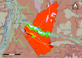
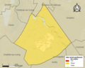 45249-Paucourt-argile.png 3,057 × 2,480; 2.83 MB
-
 45249-Paucourt-géologie.svg 1,052 × 744; 2.52 MB
-
 45061-Cepoy-géologie.svg 1,052 × 744; 2.55 MB
-
 45068-Châlette-sur-Loing-géologie.svg 1,052 × 744; 3.69 MB
-
 45076-La Chapelle-Saint-Sépulcre-géologie.svg 1,052 × 744; 928 KB
-
 45145-Ferrières-en-Gâtinais-géologie.svg 1,052 × 744; 3.4 MB
-
 45148-Fontenay-sur-Loing-géologie.svg 1,052 × 744; 3.15 MB
-
 45161-Griselles-géologie.svg 1,052 × 744; 3.23 MB


