Category:Geological maps of North Rhine-Westphalia
Jump to navigation
Jump to search
Federal states of Germany:
Subcategories
This category has the following 2 subcategories, out of 2 total.
Media in category "Geological maps of North Rhine-Westphalia"
The following 21 files are in this category, out of 21 total.
-
 Dechen Sect Aachen.jpg 2,592 × 1,936; 3.78 MB
-
 East-Westfalia - Geologic Periods.svg 2,875 × 3,259; 335 KB
-
 East-Westfalia - Geological Collection.svg 3,061 × 3,836; 9.65 MB
-
 Geologie (rus.).jpg 1,000 × 1,376; 167 KB
-
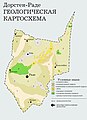
 Geologische Karte des Rheinischen Schiefergebirges.jpg 1,616 × 1,360; 313 KB
-
 Geologische Karte Dillmulde.png 2,892 × 2,565; 1.31 MB
-
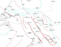
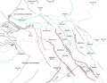
 Geologische Strukturen des Rheinischen Schiefergebirges.jpg 1,927 × 1,306; 355 KB
-
 Geologische Übersicht - Ardennen.png 1,694 × 1,360; 333 KB
-
 Geology of the Rhenish Massif.png 2,152 × 1,822; 582 KB
-
 Geology Rothaargebirge.png 2,451 × 3,501; 5.58 MB
-
 GKvereinfacht.jpg 460 × 516; 87 KB
-
 Havixsandstein24041157.jpg 3,133 × 1,864; 1.79 MB
-
 Havixsandstein24041161.jpg 2,408 × 2,048; 1.35 MB
-
 Karte Eifelkalkmulden in der Kalkeifel.png 1,027 × 1,019; 1.39 MB
-
 Mitteldevonische Grenzkalke Bierenbachtal.jpg 1,229 × 884; 92 KB
-
 Münsterland Cretaceous Basin.png 620 × 485; 418 KB
-
 OWL Geologie.png 600 × 691; 152 KB
-
 Riff Attendorn Elspe 1.jpg 800 × 664; 395 KB
-
 Roerdal graben map DE.svg 724 × 558; 596 KB
-
 Roerdal graben map EN.svg 724 × 558; 572 KB
-
 Roerdal graben map NL.svg 724 × 558; 573 KB


.jpg)


