Category:Geological maps of Armorican Massif
Jump to navigation
Jump to search
Media in category "Geological maps of Armorican Massif"
The following 20 files are in this category, out of 20 total.
-
 Armorican Massif geological map-fr.svg 1,770 × 1,300; 981 KB
-
 Batholite mancellien.svg 1,770 × 1,340; 1.03 MB
-
 Carte géologique de Bubry.jpg 1,123 × 794; 87 KB
-
 Carte géologique de Ploumanac'h.png 1,770 × 1,340; 750 KB
-
 Dykes doléritiques trias-lias Massif armoricain.png 3,508 × 2,480; 619 KB
-
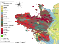
 Geologic map Armorican Massif BR.svg 1,770 × 1,340; 985 KB
-
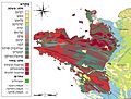
 Geologic map Armorican Massif EN.svg 1,770 × 1,340; 986 KB
-
 Geologic map Armorican Massif es.svg 1,770 × 1,340; 1.13 MB
-
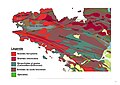
 Geologic map Armorican Massif FR.svg 1,770 × 1,340; 962 KB
-
 Geologic map Armorican Massif HE.jpg 2,000 × 1,514; 485 KB
-
 Geologic map Bay of Mont Saint-Michel FR.svg 1,770 × 1,340; 992 KB
-
 Geologic map Noirmoutier FR.svg 1,770 × 1,340; 988 KB
-
 Geologic map of Armorican Massif FR.png 846 × 647; 389 KB
-
 Geologic map of Cholet.svg 1,770 × 1,340; 871 KB
-
 Geologic map of Piriac.svg 1,770 × 1,340; 873 KB
-
 Geologic map of Rhuys.svg 1,770 × 1,340; 872 KB
-
 Geologic map SE England & Channel EN.svg 1,374 × 890; 1.65 MB
-
 Geologic map SE England & NW France FR.svg 1,374 × 890; 1.44 MB
-
 Geologic map south of Armorican Massif granite belt FR.svg 1,770 × 1,340; 868 KB
-
 Sillon de Bretagne.jpg 1,123 × 794; 85 KB


