Category:Geography of the Eastern Ghats
Jump to navigation
Jump to search
- Geography of the Eastern Ghats — a major mountain range of eastern South India.
Subcategories
This category has the following 21 subcategories, out of 21 total.
*
.
A
C
K
M
N
- NH 43 (India) (7 F)
P
- Panoramas of the Eastern Ghats (25 F)
R
S
U
W
- Walkway to Simhachalam Temple (22 F)
Media in category "Geography of the Eastern Ghats"
The following 47 files are in this category, out of 47 total.
-
 A Scrub forest patch near Padmanabham.jpg 4,000 × 2,856; 7.21 MB
-
 A view of eastern ghats from Simhachalam Train station.jpg 1,600 × 976; 747 KB
-

-

-
 BRTS road at Arilova in Visakhapatnam.JPG 4,000 × 3,000; 4.79 MB
-
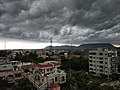
 Clouds over Eastern Ghats at Aganampudi in Visakhapatnam.JPG 4,000 × 2,550; 3.52 MB
-
 Dark Cumulonimbus.jpg 4,000 × 3,000; 4.09 MB
-
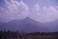 Eastern ghats and palmyra trees.jpg 3,872 × 2,592; 2.69 MB
-
 Eastern Ghats at Madhavadhara.JPG 4,000 × 3,000; 4.93 MB
-
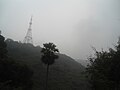 Eastern ghats at Simhachalam on a Misty day 02.JPG 4,000 × 3,000; 3.8 MB
-
 Eastern Ghats at Srungavarapukota in Vizianagaram district.jpg 1,600 × 1,200; 1.02 MB
-
 Eastern ghats view at Punyagiri.jpg 1,600 × 1,200; 588 KB
-
 Eastern ghats view at Punyagiri05.jpg 1,600 × 1,200; 813 KB
-
 Eastern Ghats view from Kailasagiri in Vizag.jpg 1,024 × 683; 204 KB
-
 Eastern Ghats view near Anakapalle.jpg 4,000 × 1,074; 1.9 MB
-
 Eastern ghats view near Elamanchili town.jpg 3,247 × 1,860; 2.54 MB
-
 Eastern Ghats view near Sontivanipalem.jpg 4,005 × 1,896; 4.67 MB
-
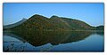 Eastern Ghats view over Gosthani Reservoir at Tatipudi.jpg 1,600 × 826; 135 KB
-
 Easternghats view awifo tour 2009.jpg 1,280 × 850; 448 KB
-
 Far view of Arilova in Visakhapatnam.JPG 4,000 × 2,598; 6.79 MB
-
 Forests at Madhavadhara 01.JPG 4,000 × 3,000; 4.84 MB
-
 Hills at Nellimarla in Vizianagaram district.jpg 1,484 × 682; 269 KB
-
 Landscape view at Paderu.jpg 2,560 × 1,440; 560 KB
-
 MountainRangesofTN&EasternGhats&Sunset.jpg 2,592 × 1,944; 895 KB
-
 Mudasarlova Reservoir view 01.jpg 1,600 × 1,200; 342 KB
-
 Palm oil plantations at the foothills of Eastern Ghats near Srungavarapukota.jpg 4,160 × 3,120; 4.17 MB
-
 Scenic view at Aganampudi of Visakhapatnam.JPG 3,174 × 1,980; 2.11 MB
-
 Scenic view at Aganampudi Visakhapatnam District.JPG 4,000 × 3,000; 3.87 MB
-
 Scenic view of Eastern ghats during monsoon at Srungavarapukota.jpg 4,160 × 1,824; 2.87 MB
-
 Shiridi Sai Temple at Boyapalem 01.jpg 1,307 × 867; 663 KB
-
 Simhachalam Gangadhara.jpg 1,440 × 823; 197 KB
-
 Simhachalam town View from Ghat road.JPG 576 × 432; 69 KB
-
 Sunset at Madhurawada during winter.JPG 4,000 × 2,874; 3.26 MB
-
 View of Aganampudi hill, Visakhapatnam district.jpg 1,200 × 885; 1.15 MB
-
 View of Duvvada hillock in Visakhapatnam.jpg 1,542 × 1,020; 789 KB
-
 View of Eastern ghats at Saripalli Village.jpg 1,509 × 1,087; 1,018 KB
-
 View of Eastern Ghats from Ramatheertham Hills.jpg 4,000 × 2,814; 4.4 MB
-
 View of Eastern Ghats from Simhachalam.jpg 800 × 521; 136 KB
-
 View of eastern ghats near Tetagunta village 01.jpg 2,560 × 1,644; 2.43 MB
-
 View of eastern ghats near Tetagunta village 02.jpg 2,560 × 1,480; 2.05 MB
-
 View of eastern ghats near Tetagunta village 03.jpg 2,560 × 1,284; 1.63 MB
-
 View of Eastern Ghats near Thadi.jpg 4,000 × 1,620; 3.87 MB
-
 View of madhuravada dome of Eastern ghats at Boyapalem.jpg 1,280 × 912; 359 KB
-
 View of Upamaka cave temple hill near Nakkapalli 01.JPG 4,000 × 3,000; 4.05 MB
-
 View of Upamaka cave temple hill near Nakkapalli 02.JPG 4,000 × 3,000; 4.05 MB
-
 Visakhapatnam, Beach Road from Kailashagiri.jpg 2,816 × 2,112; 3.05 MB
-
 Way to Medametta Buddhist remains, Chintalapalem.JPG 4,000 × 2,700; 4.53 MB


.JPG)


.JPG)