Category:Geography of Waimakariri District
Jump to navigation
Jump to search
Subcategories
This category has the following 7 subcategories, out of 7 total.
A
- Ashley River / Rakahuri (15 F)
K
L
- Lees Valley (3 F)
R
T
- Tuahiwi (2 F)
- Tūhaitara Coastal Park (7 F)
Media in category "Geography of Waimakariri District"
The following 13 files are in this category, out of 13 total.
-
 2010-09-06-Woodend.jpg 800 × 533; 746 KB
-
 Blowhard Track under Mt Richardson, New Zealand.jpg 5,341 × 3,561; 15.05 MB
-
 Blowhard Track, Mount Thomas Forest, Canterbury, New Zealand 04.jpg 5,401 × 3,601; 15.46 MB
-
 Blowhard Track, Mount Thomas Forest, Canterbury, New Zealand 05.jpg 5,472 × 3,648; 15.34 MB
-
 Bush by Glentui River, New Zealand.jpg 5,472 × 3,648; 13.38 MB
-
 Glentui River, Mount Thomas Forest, Canterbury, New Zealand 06.jpg 5,472 × 3,648; 17.48 MB
-
 Glentui River, Mount Thomas Forest, Canterbury, New Zealand 07.jpg 5,472 × 3,648; 17.97 MB
-
 Lees Valley from Mt Richardson, Mount Thomas Forest, Canterbury, New Zealand 03.jpg 5,347 × 3,565; 11.37 MB
-
 Okuku, Canterbury.jpg 4,866 × 3,244; 3.29 MB
-
 Swannanoa domain.JPG 1,617 × 644; 266 KB
-
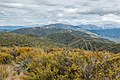
 View from Mt Richardson, Mount Thomas Forest, Canterbury, New Zealand 01.jpg 5,280 × 3,520; 9.52 MB
-
 View from Mt Richardson, Mount Thomas Forest, Canterbury, New Zealand 02.jpg 5,128 × 3,419; 12.03 MB
-
 View north from Mt Richardson, New Zealand.jpg 15,821 × 2,843; 32.96 MB


