Category:Geography of Uwajima
Jump to navigation
Jump to search
Wikimedia category | |||||
| Upload media | |||||
| Instance of | |||||
|---|---|---|---|---|---|
| |||||
Subcategories
This category has the following 13 subcategories, out of 13 total.
H
- Hiburi Island (5 F)
I
- Iwamatsu River (3 F)
K
M
- Maps of Uwajima (9 F)
N
- Nozoki-iwa (Uwajima) (3 F)
O
- Mount Onigajo (Ehime) (4 F)
S
- Mount Sanbongui (5 F)
T
U
Y
- Yukiwa Falls (5 F)
Media in category "Geography of Uwajima"
The following 20 files are in this category, out of 20 total.
-
 Akatoudai1.jpg 410 × 307; 23 KB
-
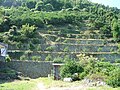 Dandan2006.jpg 410 × 307; 58 KB
-
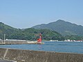
 Ebisuyama.jpg 445 × 154; 75 KB
-
 Hoketsu-pass.jpg 2,592 × 1,944; 1.05 MB
-
 Kashima Island, Uwajima Ehime Aerial photograph.2019.jpg 3,295 × 2,471; 1.67 MB
-
 Oitsukami-jima Island Aerial photograph.1975.jpg 5,642 × 3,317; 13.45 MB
-
 Okinoshima Island, Uwajima Ehime Aerial photograph.2019.jpg 2,399 × 1,800; 895 KB
-
 Satellite image of Ainan, Japan.jpg 1,280 × 2,048; 791 KB
-
 Suka-gawa river (6453917827).jpg 3,872 × 2,592; 4.45 MB
-
 Sukagawa Ehime pref.jpg 1,555 × 1,166; 275 KB
-
 Taka-shima Island Uwajima city Aerial photograph.1975.jpg 2,896 × 2,104; 2.24 MB
-
 Takamoriyama04.jpg 1,024 × 768; 110 KB
-
 Takatukiyama05.jpg 1,024 × 769; 282 KB
-
 Takega-shima Uwajima city Aerial photograph.1975.jpg 3,016 × 2,184; 2.85 MB
-
 Tojima Island, Ehime Uwajima Aerial photograph.2007.jpg 3,144 × 2,358; 992 KB
-
 Toodoshima Island, Ehime Uwajima Aerial photograph.2008.jpg 1,067 × 800; 178 KB
-
 Tsushimacho Harigi, Uwajima, Ehime Prefecture 798-3343, Japan - panoramio.jpg 3,389 × 2,262; 1.59 MB
-
 Uwajima city center area Aerial photograph.2019.jpg 10,562 × 8,040; 29.76 MB
-
 Uwajima River.JPG 1,600 × 1,200; 327 KB
-
 土石流 危険渓流 鎌川 (43322314165).jpg 4,032 × 3,024; 7.4 MB


.jpg)


.jpg)