<nowiki>Category:Geography of Tana municipality; Kategori:Geografi i Tana; Kategori:Tanas geografi; categoría de Wikimedia; kategori Wikimedia; Wikimedia:Klassys; Уикимедия категория; Vikimedya kategorisi; ویکیمیڈیا زمرہ; kategória projektov Wikimedia; категорія проєкту Вікімедіа; kawan Wikimèdia; гурӯҳи Викимедиа; Wikimedia-Kategorie; 위키미디어 분류; Wikimedia-bólkur; kategorio en Vikimedio; Викимедиина категорија; kategorija na Wikimediji; Wikimedia:Ronnaghys; উইকিমিডিয়া বিষয়শ্রেণী; page de catégorie d'un projet Wikimédia; kategori Wikimedia; kategorija na Wikimediji; Wikimedia-kategorie; pajenn rummata eus Wikimedia; categoría de Wikimedia; विकिपीडिया वर्ग; kategorija w projektach Wikimedije; thể loại Wikimedia; विकिपीडिया:श्रेणी; Wikimedia projekta kategorija; kategoria ti Wikimedia; категорија на Викимедији; категория в проекте Викимедиа; Wikimedia-kategori; categorie în cadrul unui proiect Wikimedia; Wikimedia category; категорияд Ангилал; Wikimedia-kategori; Wikimedia-kategori; kategori Wikimédia; kategori Wikimedia; د ويکيمېډيا وېشنيزه; Wikimedia-categorie; پۆلی ویکیمیدیا; Wikimedia category; تصنيف ويكيميديا; Vikimédia ñemohenda; 维基媒体项目分类; Wikimedia:ကဏ္ဍခွဲခြင်း; 維基媒體分類; Wikimédia-kategória; વિકિપીડિયા શ્રેણી; kategoria w projekcie Wikimedia; Wikimediako kategoria; หน้าหมวดหมู่วิกิมีเดีย; categoría de Wikimedia; Wikimedia-categorie; Викимедиа категорияһы; Wikimedia-Kategorie; Wikimedia-kategoriija; катэгорыя ў праекце Вікімедыя; Վիքիմեդիայի նախագծի կատեգորիա; Wikimedia-kategorie; Wikimedia-kategori; विकिमिडिया श्रेणी; ウィキメディアのカテゴリ; categoria Wikimedia; Wikimedia-Kategorie; تصنيف بتاع ويكيميديا; קטגוריה בוויקיפדיה; විකිමීඩියා ප්රභේද පිටුව; categoria Vicimediorum; Wîkîmediya:Kategorî; विकिमीडिया श्रेणी; Wikimedia-Kategorie; Wikimedia-luokka; Viciméid catagóir; Wikimedia-categorie; tudalen categori Wikimedia; விக்கிமீடியப் பகுப்பு; categoria di un progetto Wikimedia; катэгорыя ў праекце Вікімэдыя; Wikimedia-kategory; Kategoriya ning Wikimedia; Wikimedia kategooria; kategori e Wikimedias; رده ویکیمدیا; Vikipidiya:Shopni; kategorie na projektech Wikimedia; ẹ̀ka Wikimedia; catigurìa di nu pruggettu Wikimedia; categoria de um projeto da Wikimedia; kategori Wikimedia; Wikimedia категориясы; tumbung Wikimedia; Викимедиа проектындагы төркем; kategorija Wikimedie; kategorya ng Wikimedia; विकिमिडिया श्रेणी; ვიკიპედია:კატეგორიზაცია; kategori Wikimedia; jamii ya Wikimedia; വിക്കിമീഡിയ വർഗ്ഗം; Wikimedia:Kategorija; kategori Wikimedia; categurìa 'e nu pruggette Wikimedia; زمرو:وڪيپيڊيا زمرا بندي; Wikimedia-Kategorie; categoría de Wikimedia; categoria de Wikimedia; κατηγορία εγχειρημάτων Wikimedia; Wikimedia-Kategorie</nowiki>
Subcategories
This category has the following 5 subcategories, out of 5 total.

 1989.06.04 Smalfjord.jpg 1,740 × 1,172; 440 KB
 Frozen banks of the Tana river, Norway.jpg 1,600 × 1,200; 1.2 MB
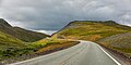 Fylkesveg 98 in Geaidnonjoaski valley in Tana, Troms og Finnmark, Norway, 2022 August.jpg 5,000 × 2,483; 11.73 MB
 Geaidnonjoaski valley in Tana, Troms og Finnmark, Norway, 2022 August.jpg 5,000 × 3,333; 18.66 MB
 Midnight sun Tana.jpg 3,648 × 2,736; 1.61 MB
 Máttimuš Borsejohka.jpg 3,648 × 2,736; 3.78 MB
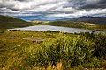

 Tana Ifjordfjellet.JPG 2,304 × 1,728; 958 KB
 Tana Smalfjorden.JPG 2,304 × 1,728; 1,021 KB
 Tana-2012-07-09-10-06-002.jpg 2,560 × 1,440; 1.03 MB
 Tana-2012-07-09-10-25-003.jpg 2,560 × 1,440; 746 KB
 Tana. Masjok. - no-nb digifoto 20150225 00097 NB MIT FNR 10862.jpg 7,210 × 5,410; 3.2 MB
 Torhop.JPG 3,729 × 2,310; 3.77 MB
 Upland landscape at Poastagurjávri in Tana, Troms og Finnmark, Norway, 2022 August.jpg 5,000 × 3,334; 16.62 MB
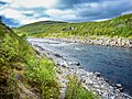 Utsjoki-Nuorgam Tenojoki.JPG 2,304 × 1,728; 3.44 MB
 Waiting for the midnight sun.jpg 3,648 × 2,736; 3.39 MB


