Category:Geography of Taku, Saga
Jump to navigation
Jump to search
日本語: 佐賀県多久市の地理
Subcategories
This category has the following 2 subcategories, out of 2 total.
S
- Seikei Park (9 F)
T
- Mount Ten (Saga) (13 F)
Media in category "Geography of Taku, Saga"
The following 18 files are in this category, out of 18 total.
-
 Chuo Park Taku.jpg 5,178 × 2,589; 8.06 MB
-
 Eocene sandstone riverbed of Imaide River.jpg 5,448 × 3,632; 13 MB
-
 Homanzan Park in Itaya, Taku.jpg 5,400 × 2,700; 8.4 MB
-
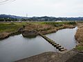
 Lift waterway bridge in Befu 01.jpg 4,032 × 3,024; 3.3 MB
-
 Mature "Sagabiyori" rice plants on field in Minamitaku.jpg 4,608 × 3,456; 6.6 MB
-
 Mount Hachiman from Nishitaku.jpg 5,448 × 3,632; 10.94 MB
-
 Mount Oninohana peak from Park.jpg 5,448 × 3,632; 10 MB
-
 Mount Oninohana ridge line from Takumachi, Taku.jpg 5,000 × 2,500; 7.85 MB
-
 Mount Onna from Nishitaku.jpg 5,448 × 3,632; 12.16 MB
-
 Mount Tenzan from Minamitaku.jpg 4,608 × 3,456; 6.56 MB
-
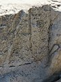
 Sandstone at riverbed of Imaide River.jpg 5,010 × 3,340; 8.74 MB
-
 Sayanomoto stepping stones of Imari kaido in Taku.jpg 4,842 × 3,632; 9.44 MB
-
 Taku basin from Mt.Oninohana.jpg 5,400 × 2,250; 6.17 MB
-
 Trace fossil in sandstone at Imaide River 01.jpg 2,220 × 2,960; 4.21 MB
-
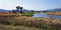 Ushizu River and Mutabe Dry Detention Basin from a confluence.jpg 5,400 × 2,700; 10.47 MB
-
 Work of rice straw baling in Minamitaku.jpg 4,608 × 3,456; 6.71 MB
-
 Yoshinotani Subgroup coal seams in Sunahara, Taku 01.jpg 5,448 × 2,724; 14.66 MB
-
 Yoshinotani Subgroup coal seams in Sunahara, Taku 02.jpg 5,448 × 3,632; 17.71 MB


