Category:Geography of Schweinfurt
Jump to navigation
Jump to search
Urban districts (cities): Amberg · Ansbach · Aschaffenburg · Augsburg · Bamberg · Bayreuth · Coburg · Erlangen · Fürth · Hof · Ingolstadt · Kaufbeuren · Kempten · Landshut · Memmingen · Munich · Nuremberg · Passau · Regensburg · Rosenheim · Schwabach · Schweinfurt · Straubing · Weiden in der Oberpfalz · Würzburg
Wikimedia category | |||||
| Upload media | |||||
| Instance of | |||||
|---|---|---|---|---|---|
| |||||
Subcategories
This category has the following 5 subcategories, out of 5 total.
Media in category "Geography of Schweinfurt"
The following 14 files are in this category, out of 14 total.
-
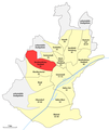
 Karte Schweinfurt, Stadtteil 11-13 Innenstadt.png 1,344 × 1,594; 188 KB
-
 Karte Schweinfurt, Stadtteil 21 Bergl.png 1,344 × 1,594; 188 KB
-
 Karte Schweinfurt, Stadtteil 31 Nordwestlicher Stadtteil.png 1,344 × 1,594; 190 KB
-
 Karte Schweinfurt, Stadtteil 32 Gartenstadt.png 1,344 × 1,594; 188 KB
-
 Karte Schweinfurt, Stadtteil 33 Nördlicher Stadtteil.png 1,344 × 1,594; 189 KB
-
 Karte Schweinfurt, Stadtteil 34 Haardt.png 1,344 × 1,594; 188 KB
-
 Karte Schweinfurt, Stadtteil 35 Eselshöhe.png 1,344 × 1,594; 188 KB
-
 Karte Schweinfurt, Stadtteil 41 Hochfeld - Steinberg.png 1,344 × 1,594; 190 KB
-
 Karte Schweinfurt, Stadtteil 42 Nordöstlicher Stadtteil.png 1,344 × 1,594; 189 KB
-
 Karte Schweinfurt, Stadtteil 43-47 Deutschhof.png 1,344 × 1,594; 189 KB
-
 Karte Schweinfurt, Stadtteil 52 Hafen-West.png 1,344 × 1,594; 189 KB
-
 Karte Schweinfurt, Stadtteil 53-54 Maintal.png 1,344 × 1,594; 188 KB
-
 Karte Schweinfurt, Stadtteil 61-62 Oberndorf.png 1,344 × 1,594; 189 KB
-
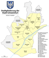 Karte Stadtteile Stadt Schweinfurt.png 1,344 × 1,594; 270 KB


