Category:Geography of Ruhpolding
Jump to navigation
Jump to search
Subcategories
This category has the following 9 subcategories, out of 9 total.
D
- Dürrnbachhorn (2 F)
H
- Hörndlwand (5 F)
M
- Mittersee (Ruhpolding) (7 F)
R
S
- Sonntagshorn (20 F)
- Streicher (Chiemgauer Alpen) (9 F)
Media in category "Geography of Ruhpolding"
The following 11 files are in this category, out of 11 total.
-
 26.12.2007. Ruhpolding - panoramio.jpg 1,392 × 784; 223 KB
-
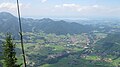 Blick vom Rauschberg auf ruhpolding.JPG 3,648 × 2,048; 1.85 MB
-
 Blick vom Unternberg auf Ruhpolding.jpg 6,000 × 3,376; 3.98 MB
-
 Blick von hier in die Berglandschaft - panoramio.jpg 3,008 × 2,000; 1.46 MB
-
 Chiemgau Alps, Ruhpolding, Germany (Unsplash).jpg 5,172 × 2,892; 14.49 MB
-
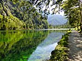
 Foerchensee Ruhpolding.jpg 916 × 791; 421 KB
-
 FoerchenseeSeehaus.jpg 960 × 720; 189 KB
-
 Parkplatz in der Laubau - geo.hlipp.de - 13293.jpg 480 × 640; 54 KB
-
 Rhpdg O Ansicht.jpg 1,561 × 923; 308 KB
-
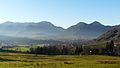 Ruhpolding v SO 01.jpg 2,560 × 1,440; 1.69 MB
-
 Ruhpolding.jpg 1,984 × 1,488; 570 KB


.jpg)


