Category:Geography of New York (state)
Jump to navigation
Jump to search
States of the United States: Alabama · Alaska · Arizona · Arkansas · California · Colorado · Connecticut · Delaware · Florida · Georgia · Hawaii · Idaho · Illinois · Indiana · Iowa · Kansas · Kentucky · Louisiana · Maine · Maryland · Massachusetts · Michigan · Minnesota · Mississippi · Missouri · Montana · Nebraska · Nevada · New Hampshire · New Jersey · New Mexico · New York · North Carolina · North Dakota · Ohio · Oklahoma · Oregon · Pennsylvania · Rhode Island · South Carolina · South Dakota · Tennessee · Texas · Utah · Vermont · Virginia · Washington · West Virginia · Wisconsin · Wyoming – District of Columbia: Washington, D.C.
insular area of the United States: American Samoa · Guam · Northern Mariana Islands · Puerto Rico · United States Virgin Islands – Baker Island · Howland Island · Jarvis Island · Johnston Atoll · Kingman Reef · Midway Atoll · Navassa Island · Palmyra Atoll · Wake Island
insular area of the United States: American Samoa · Guam · Northern Mariana Islands · Puerto Rico · United States Virgin Islands – Baker Island · Howland Island · Jarvis Island · Johnston Atoll · Kingman Reef · Midway Atoll · Navassa Island · Palmyra Atoll · Wake Island
English: Geography of New York
state of the United States | |||||
| Upload media | |||||
| Instance of |
| ||||
|---|---|---|---|---|---|
| Subclass of | |||||
| Facet of | |||||
| Location |
| ||||
 | |||||
Subcategories
This category has the following 27 subcategories, out of 27 total.
+
B
- Braddock Bay (4 F)
C
E
G
I
L
N
O
- Outer Lands (New England) (1 F)
P
- Portageville, New York (13 F)
R
S
- Schuyler Flatts (15 F)
T
- Tug Hill Plateau (1 F)
V
Media in category "Geography of New York (state)"
The following 18 files are in this category, out of 18 total.
-
 05 Tilly Foster Mine.jpg 1,792 × 1,200; 551 KB
-
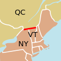 45th parallel US Canada.svg 250 × 250; 32 KB
-
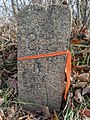 82 Mile Stone.jpg 3,024 × 4,032; 4.69 MB
-
 Area code 845.png 400 × 465; 33 KB
-
 Beatty Points, New York.JPG 3,072 × 2,304; 3.06 MB
-
 Claudius Smith Rock on Harriman Park Blue Disc Trail.jpg 360 × 278; 36 KB
-
 Report of the regents of the University, on the boundaries of the state of New York (IA cu31924024932539).pdf 766 × 1,302, 380 pages; 10.44 MB
-
 Geologic cross section of Devonian strata from New York to Alabama.svg 1,000 × 500; 221 KB
-
 High Bank and Cascade, Parish Glen (NYPL b11708217-G91F092 039ZF).tiff 2,964 × 2,019; 17.12 MB
-
 Palisades Sill Location Map.jpg 634 × 460; 85 KB
-
 PSM V13 D674 Bird eye view of new york harbor.jpg 1,590 × 1,020; 436 KB
-

-
 Report of the regents of the University, on the boundaries of the state of New York (IA reportofregentso01unive).pdf 777 × 1,318, 376 pages; 20.69 MB
-
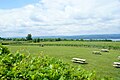 Seneca Lake vineyards.jpg 3,872 × 2,592; 1.17 MB
-
 Seven Hills Trail.jpg 1,931 × 1,305; 1.04 MB
-
 USGS 2006 1237 Fig7b.png 1,713 × 709; 138 KB
-
 Water clouds - panoramio.jpg 4,000 × 3,000; 2.85 MB
-
 Winter 08 124.jpg 1,728 × 2,304; 1.23 MB


