Category:Geography of Nagakute
Jump to navigation
Jump to search
日本語: 愛知県長久手市の地理。
Wikimedia category | |||||
| Upload media | |||||
| Instance of | |||||
|---|---|---|---|---|---|
| |||||
Subcategories
This category has the following 3 subcategories, out of 3 total.
P
Media in category "Geography of Nagakute"
The following 29 files are in this category, out of 29 total.
-
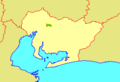
 Aichi-nagakute-town.svg 561 × 506; 26 KB
-
 Apis mellifera on a flower 20091108.jpg 1,660 × 1,660; 1.6 MB
-
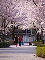 Cherry Blossom Trees along Kanare-gawa River, Nodano Nagakute 2011.jpg 1,200 × 1,600; 2.22 MB
-
 Headstream kanare river.jpg 2,400 × 1,800; 3.94 MB
-
 Manufacturing Valley、MoricoroPark, Aichi - panoramio.jpg 1,600 × 1,200; 856 KB
-
 Mihatayama.JPG 6,000 × 4,000; 5.77 MB
-
 Nagakute city center area Aerial photograph.1987.jpg 3,781 × 2,775; 7.49 MB
-
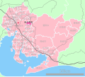
 Nagakute in Aichi Prefecture Ja.svg 539 × 484; 20 KB
-
 Nagakute.png 210 × 155; 6 KB
-
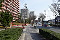 Nagakuteshi1.JPG 3,600 × 2,400; 1.84 MB
-
 Nagakuteshiryoushitsu.JPG 6,000 × 4,000; 4.52 MB
-
 Population distribution of Nagakute, Aichi, Japan.svg 512 × 256; 22 KB
-
 Triangulation Point on the Top of Mount Takasumi-yama (1), Nedake Nagakute 2021.jpg 1,500 × 1,000; 2.09 MB
-
 Triangulation Point on the Top of Mount Takasumi-yama (2), Nedake Nagakute 2021.jpg 1,500 × 1,000; 1.66 MB
-
 Uedagawa 20110428 1.jpg 2,048 × 1,536; 677 KB
-
 モリコロパーク1.JPG 1,600 × 1,200; 1.02 MB
-
 モリコロパーク駐車場 (愛知県愛知郡長久手町) - panoramio.jpg 1,804 × 1,224; 366 KB
-
 地図-愛知県長久手町-2006.png 300 × 205; 6 KB
-
 岩作あんどんの会 - panoramio.jpg 640 × 480; 46 KB
-
 長久手町 - panoramio (1).jpg 3,648 × 2,736; 3.85 MB
-
 長久手町 - panoramio (2).jpg 3,648 × 2,736; 3.84 MB
-
 長久手町 - panoramio (3).jpg 3,648 × 2,736; 4.08 MB
-
 長久手町 - panoramio (4).jpg 3,648 × 2,736; 4.06 MB
-
 長久手町 - panoramio (5).jpg 3,648 × 2,736; 4.31 MB
-
 長久手町 - panoramio (6).jpg 3,648 × 2,736; 4.32 MB
-
 長久手町 - panoramio (7).jpg 3,648 × 2,736; 3.73 MB
-
 長久手町 - panoramio (8).jpg 1,936 × 2,592; 2.37 MB
-
 長久手町 - panoramio.jpg 3,648 × 2,736; 3.87 MB
-
 長久手町立てこもり事件の現場(現在).jpg 3,647 × 2,426; 2.42 MB


,_Nedake_Nagakute_2021.jpg)
,_Nedake_Nagakute_2021.jpg)


_-_panoramio.jpg)


.jpg)
.jpg)
.jpg)
.jpg)
.jpg)
.jpg)
.jpg)
.jpg)

.jpg)