Category:Geography of Mino, Gifu
Jump to navigation
Jump to search
日本語: 岐阜県美濃市の地理。
Subcategories
This category has the following 8 subcategories, out of 8 total.
Media in category "Geography of Mino, Gifu"
The following 30 files are in this category, out of 30 total.
-
 Gongen Fall 20210914 01.jpg 4,608 × 3,456; 6.94 MB
-
 Gongen Fall 20210914 02.jpg 4,608 × 3,456; 6.61 MB
-
 Gongen Fall 20210914 03.jpg 4,608 × 3,456; 6.5 MB
-
 Kamimaki Bridge over Itadori River.jpg 6,000 × 4,000; 18.8 MB
-
 Kanomizu Riv. 20210914.jpg 4,608 × 3,456; 7.69 MB
-
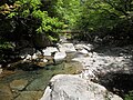
 Katachi river, Mino, 2013.JPG 4,608 × 3,456; 5.93 MB
-
 Katazikeikoku.JPG 2,000 × 1,500; 1.65 MB
-
 Kayu river, Mino, 2013.JPG 4,608 × 3,456; 4.62 MB
-
 Mino city center area Aerial photograph.1982.jpg 4,109 × 5,335; 15.99 MB
-
 Mino Gifu and Mount Matsukura.jpg 2,560 × 1,707; 922 KB
-
 Mino in Gifu Prefecture Ja.svg 660 × 780; 36 KB
-
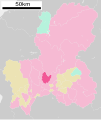
 Mino in Gifu Prefecture.png 1,101 × 901; 47 KB
-
 Mino montage.JPG 365 × 497; 110 KB
-
 Mutsu Bridge over Itadori River.jpg 6,000 × 4,000; 11.37 MB
-
 Nagara River from Kanmo Bridge.jpg 6,000 × 4,000; 11.82 MB
-
 Nagara River from Mount Ogura.jpg 6,000 × 4,000; 10.38 MB
-
 Observation Kozuchi-town from Mt.Ogura.jpg 4,256 × 2,832; 6.58 MB
-
 Ogura park, Mino 2015.jpg 5,152 × 3,864; 5.36 MB
-
 Ohime no Ido 20220507 01.jpg 4,608 × 3,072; 3.63 MB
-
 Ohime no Ido 20220507 02.jpg 4,608 × 3,072; 3.53 MB
-
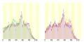 Population distribution of Mino, Gifu, Japan.svg 512 × 256; 22 KB
-
 Pot hole at Izumichō 20220507.jpg 4,608 × 3,072; 3.48 MB
-
 上有知町字絵図表紙1889年(明治21年).jpg 2,048 × 1,195; 833 KB
-
 岐阜県武儀郡上有知町地図 明治44年.jpg 679 × 960; 129 KB
-
 岐阜県美濃市 - panoramio - gundam2345 (1).jpg 2,048 × 1,102; 786 KB
-
 岐阜県美濃市大矢田 - panoramio - gundam2345 (1).jpg 1,920 × 1,440; 732 KB
-
 岐阜県美濃市大矢田(ひんここまつり会場) - panoramio - gundam2345.jpg 4,912 × 1,080; 1.2 MB
-
 岐阜県美濃市大矢田(ひんここまつり会場) - panoramio.jpg 2,048 × 1,536; 1.34 MB
-
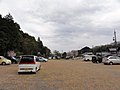 岐阜県美濃市大矢田(ひんここまつり駐車場) - panoramio.jpg 1,920 × 1,440; 555 KB
-
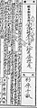 杉原千畝氏の戸籍の出生についての記載.jpg 456 × 1,333; 420 KB


.jpg)

.jpg)
.jpg)
_-_panoramio.jpg)
_-_panoramio.jpg)
_-_panoramio_-_gundam2345.jpg)