日本語: 愛知県額田郡幸田町の地理。
<nowiki>Category:Geography of Kota; Category:幸田町の地理; विकिमिडिया श्रेणी; Wikimedia-Kategorie; κατηγορία εγχειρημάτων Wikimedia; Wikimedia-Kategorie; Wikimedia:Klassys; kategorija na Wikimediji; kategorie na projektech Wikimedia; Wikimedia category; kategori Wikimedia; categurìa 'e nu pruggette Wikimedia; Wikimedia-categorie; Wikimedia:Ronnaghys; Wikimedia category; د ويکيمېډيا وېشنيزه; Уикимедия категория; kategoria w projekcie Wikimedia; Vikimedya kategorisi; ویکیمیڈیا زمرہ; หน้าหมวดหมู่วิกิมีเดีย; ردهٔ ویکیپدیا; Wikimedia-kategori; категория в проекте Викимедиа; категорія проєкту Вікімедіа; kawan Wikimèdia; 維基媒體專案分類; 维基媒体分类; Wikimedia-Kategorie; 위키미디어 분류; Wikimedia-bólkur; kategorio en Vikimedio; Викимедиина категорија; Wikimedia-Kategorie; categoría de Wikimedia; উইকিমিডিয়া বিষয়শ্রেণী; page de catégorie d'un projet Wikimedia; kategori Wikimedia; kategorija na Wikimediji; kategorya ng Wikimedia; 维基媒体分类; Wikimedia-kategori; 維基媒體分類; विकिपीडिया वर्ग; kategorija w projektach Wikimedije; thể loại Wikimedia; 维基媒体项目分类; Wikimedia projekta kategorija; Wikimedia-kategorie; категорија на Викимедији; гурӯҳи Викимедиа; Wikimedia категориясы; categoria de um projeto da Wikimedia; 维基媒体分类; категорияд Ангилал; Wikimedia-kategori; Wikimedia-kategori; kategori Wikimédia; kategori Wikimedia; Wikimedia-Kategorie; kategori Wikimedia; پۆلی ویکیمیدیا; Wikimedia category; تصنيف ويكيميديا; Vikimédia ñemohenda; pajenn rummata eus Wikimedia; Wikimedia:ကဏ္ဍခွဲခြင်း; 維基媒體分類; Wikimédia-kategória; વિકિપીડિયા શ્રેણી; Wikimedia-kategoriija; Wikimediako kategoria; 維基媒體分類; categoría de Wikimedia; categoria de Wikimedia; Wikimedia-Kategorie; Wikimedia-Kategorie; kategori e Wikimedias; Viciméid catagóir; Վիքիմեդիայի նախագծի կատեգորիա; Wikimedia-kategorie; Wîkîmediya:Kategorî; विकिमिडिया श्रेणी; ウィキメディアのカテゴリ; categoria Wikimedia; tudalen categori Wikimedia; تصنيف بتاع ويكيميديا; Wikimedia kategooria; විකිමීඩියා ප්රභේද පිටුව; Викимедиа проектындагы төркем; катэгорыя ў праекце Вікімэдыя; विकिमीडिया श्रेणी; kategória projektov Wikimedia; Wikimedia-luokka; гурӯҳ дар лоиҳаи Викимедиа; Wikimedia-categorie; Wikimedia-categorie; விக்கிமீடியப் பகுப்பு; categoria di un progetto Wikimedia; gurühi Vikimedia; Vikipidiya:Shopni; Wikimedia category; 維基媒體分類; विकिपीडिया:श्रेणी; Викимедиа проектындагы төркем; categoria Vicimediorum; קטגוריה בוויקיפדיה; ẹ̀ka Wikimedia; catigurìa di nu pruggettu Wikimedia; categoria de um projeto da Wikimedia; ვიკიპედია:კატეგორიზაცია; Wikimedia-kategory; tumbung Wikimedia; катэгорыя ў праекце Вікімедыя; kategorija Wikimedie; Wikimedia proyektındağı törkem; Викимедиа категорияһы; categoría de Wikimedia; kategori Wikimedia; jamii ya Wikimedia; വിക്കിമീഡിയ വർഗ്ഗം; Wikimedia:Kategorija; kategori Wikimedia; Kategoriya ning Wikimedia; زمرو:وڪيپيڊيا زمرا بندي; Wikimedia-Kategorie; categoría de Wikimedia; categorie în cadrul unui proiect Wikimedia; 维基媒体项目分类; kategoria ti Wikimedia</nowiki>
Category:Geography of Kota Wikimedia category |
| Upload media |
|
| Instance of | |
|---|
|
 |
Subcategories
This category has the following 6 subcategories, out of 6 total.

 Aichi-kota-town.svg 561 × 506; 26 KB
 Farmland in Hishiike, Kota-cho ac (1).jpg 5,863 × 3,899; 2.16 MB
 Fukozu-jinja ac.jpg 4,478 × 2,978; 2.88 MB
 Hishiike reclaimed land ac (1).jpg 5,961 × 3,964; 4.42 MB
 Hishiike reclaimed land ac (2).jpg 5,863 × 3,899; 3.92 MB
 Koda River 080831.jpg 2,816 × 2,112; 1.83 MB
 Koda Station Intersection 101202.jpg 2,841 × 2,130; 1.24 MB
 Kota fire ruins ac.jpg 5,999 × 3,988; 2.82 MB
 Kota in Aichi Prefecture Ja.svg 539 × 484; 21 KB
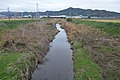 Kota river in Hishiike, Kota-cho ac.jpg 6,002 × 3,991; 4.51 MB
 Kota town Ike-jinja ac (2).jpg 6,015 × 4,000; 3.47 MB
 Kota-takoage.jpg 5,232 × 3,488; 2.4 MB
 Map of Kota-cho 2012.png 2,280 × 2,430; 1.19 MB
 Population distribution of Kota, Aichi, Japan.svg 512 × 256; 22 KB
 View from Mount Sangane, Kota-cho Nukata-gun 2012.JPG 1,600 × 1,200; 1.85 MB
 View of Central Fukouzu from Mount Sangane, Kota-cho Nukata-gun 2012.JPG 1,500 × 1,000; 1.73 MB
 地図-愛知県幸田町-2006.png 300 × 205; 6 KB
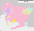 基礎自治体位置図 23501.svg 539 × 484; 13 KB
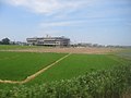 幸田町 - panoramio.jpg 4,000 × 3,000; 2.17 MB
.jpg)

.jpg)
.jpg)


.jpg)


