Category:Geography of Koshu, Yamanashi
Jump to navigation
Jump to search
| NO WIKIDATA ID FOUND! Search for Geography of Koshu, Yamanashi on Wikidata | |
| Upload media |
日本語: 山梨県甲州市の地理。
Subcategories
This category has the following 9 subcategories, out of 9 total.
Media in category "Geography of Koshu, Yamanashi"
The following 115 files are in this category, out of 115 total.
-
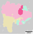 Koshu in Yamanashi Prefecture Ja.svg 503 × 521; 10 KB
-
 Koshu in Yamanashi Prefecture.png 1,001 × 801; 37 KB
-
 2008-05-31 Vineyards and houses near Kofu.jpg 2,400 × 1,600; 1.14 MB
-
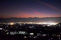 2017-11-02 night cityscape in Koshu, Yamanashi.jpg 5,000 × 3,330; 9.2 MB
-
 Daibosatsurei hiking (51750892643).jpg 5,619 × 3,746; 7.39 MB
-
 Daibosatsurei hiking (51751298189).jpg 5,967 × 3,978; 8.46 MB
-
 Daibosatsurei-03 (51751298469).jpg 5,878 × 3,919; 6.5 MB
-
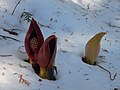
 Eastern Skunk Cabbage Takemori Koshu-City A.JPG 4,000 × 3,000; 3.88 MB
-
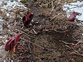
 Eastern Skunk Cabbage Takemori Koshu-City B.JPG 4,000 × 3,000; 4.59 MB
-
 Eastern Skunk Cabbage Takemori Koshu-City C.JPG 4,000 × 3,000; 5.32 MB
-
 Eastern Skunk Cabbage Takemori Koshu-City D.JPG 4,000 × 3,000; 3.94 MB
-
 Eastern Skunk Cabbage Takemori Koshu-City E.JPG 4,000 × 3,000; 4.03 MB
-
 Enzan district Koshu city Aerial photograph.1976.jpg 4,667 × 3,478; 14.89 MB
-
 Enzan Islamic Graveyard 01.JPG 2,560 × 1,920; 3.96 MB
-
 EnzanCity-YamanashiPref.png 600 × 500; 97 KB
-
 Enzankamiozo, Koshu, Yamanashi Prefecture 404-0042, Japan - panoramio.jpg 1,134 × 1,044; 727 KB
-
 Enzanoyashiki, Koshu, Yamanashi Prefecture 404-0053, Japan - panoramio (1).jpg 3,072 × 2,304; 3.08 MB
-
 Enzanoyashiki, Koshu, Yamanashi Prefecture 404-0053, Japan - panoramio.jpg 3,072 × 2,304; 3.34 MB
-

-
 Grapes in Katsunuma.jpg 5,312 × 2,988; 4.11 MB
-
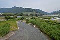 Hikawa River ac.jpg 5,768 × 3,835; 3.23 MB
-
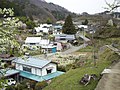 Kamijo settlement 1.JPG 3,296 × 2,472; 2.07 MB
-
 Kamijo settlement 2.JPG 3,296 × 2,472; 2.03 MB
-
 Kamijo settlement 5.JPG 3,296 × 2,472; 2.02 MB
-
 Katsunuma 1.jpg 2,048 × 1,536; 922 KB
-
 Katsunuma 2.jpg 2,048 × 1,536; 1.02 MB
-
 Katsunuma 3.jpg 2,048 × 1,536; 1.23 MB
-
 Katsunuma 4.jpg 2,048 × 1,536; 1.28 MB
-
 Katsunuma 5.jpg 2,048 × 1,536; 1.22 MB
-
 Katsunuma vineyard 02.jpg 1,024 × 768; 533 KB
-
 Katsunuma vineyard ac (1).jpg 5,973 × 3,971; 3.17 MB
-
 Katsunuma vineyard ac (2).jpg 5,922 × 3,938; 3.25 MB
-
 Katsunuma vineyard ac (3).jpg 5,999 × 3,988; 4.48 MB
-
 Katsunuma vineyard ac (4).jpg 5,981 × 3,977; 4.56 MB
-
 Katsunuma vineyard ac (5).jpg 5,973 × 3,971; 4.54 MB
-
 Katsunuma vineyard ac (6).jpg 5,999 × 3,988; 4.81 MB
-
 Katsunuma vineyard.jpg 768 × 1,024; 502 KB
-
 Katsunuma.jpg 640 × 480; 76 KB
-
 KatsunumaTown-YamanashiPref.png 600 × 500; 97 KB
-
 Katunumamusen.JPG 960 × 1,280; 319 KB
-
 Koshu Grapes.jpg 2,048 × 1,536; 637 KB
-
 Koshu011.jpg 1,772 × 1,188; 536 KB
-
 Koshushi 2018-1.jpg 4,496 × 3,000; 7.49 MB
-
 Koshushi 2018-2.jpg 4,496 × 3,000; 7.11 MB
-
 Koshushi 2018-3.jpg 4,496 × 3,000; 7.48 MB
-
 Aerial photographs of Kyodo River Alluvial fan.jpg 3,333 × 3,267; 2.87 MB
-
 Kyodo River Alluvial fan written name of a place Aerial photographs.jpg 3,487 × 3,262; 4.3 MB
-
 Matsuzato Koro-Gaki of dried persimmon for gifts.JPG 3,864 × 2,898; 6.59 MB
-
 Mt. Kurodake (Daibosatsu).JPG 2,048 × 1,536; 707 KB
-
 Norobasi-1.jpg 4,496 × 3,000; 6.64 MB
-
 Pione Grapes.jpg 2,048 × 1,536; 524 KB
-
 Population distribution of Koshu, Yamanashi, Japan.svg 512 × 256; 22 KB
-
 Shimoiwasaki vineyard ac (1).jpg 5,964 × 3,966; 3.15 MB
-
 Shimoiwasaki vineyard ac (10).jpg 5,964 × 3,966; 4.86 MB
-
 Shimoiwasaki vineyard ac (11).jpg 5,973 × 3,971; 3.84 MB
-
 Shimoiwasaki vineyard ac (12).jpg 5,947 × 3,954; 3.84 MB
-
 Shimoiwasaki vineyard ac (13).jpg 5,981 × 3,977; 4.85 MB
-
 Shimoiwasaki vineyard ac (14).jpg 5,973 × 3,971; 3.37 MB
-
 Shimoiwasaki vineyard ac (15).jpg 5,964 × 3,966; 3.74 MB
-
 Shimoiwasaki vineyard ac (2).jpg 5,646 × 3,754; 2.37 MB
-
 Shimoiwasaki vineyard ac (3).jpg 5,981 × 3,977; 4.4 MB
-
 Shimoiwasaki vineyard ac (4).jpg 5,777 × 3,841; 3.3 MB
-
 Shimoiwasaki vineyard ac (5).jpg 5,981 × 3,977; 4.07 MB
-
 Shimoiwasaki vineyard ac (6).jpg 5,973 × 3,971; 5.12 MB
-
 Shimoiwasaki vineyard ac (7).jpg 5,305 × 3,979; 2.59 MB
-
 Shimoiwasaki vineyard ac (8).jpg 5,990 × 3,983; 2.71 MB
-
 Shimoiwasaki vineyard ac (9).jpg 5,589 × 3,716; 3.54 MB
-
 Shiono-yama.JPG 400 × 300; 34 KB
-
 Signboard of Certain Hunting Equipment Prohinited Area (Gun).JPG 4,000 × 3,000; 4.83 MB
-
 Signboard of Eastern Skunk Cabbage Takemori Koshu-City.JPG 4,000 × 3,000; 4.71 MB
-
 Snow - panoramio (29).jpg 1,200 × 1,200; 386 KB
-
 Snow - panoramio (30).jpg 1,200 × 1,200; 417 KB
-
 Susuki 061112a.jpg 2,400 × 1,600; 3.09 MB
-
 Unpoji-Temple old stone stairway.JPG 4,000 × 3,000; 8.43 MB
-
 Walk road of Eastern Skunk Cabbage Takemori Koshu-City.JPG 4,000 × 3,000; 5.72 MB
-
 Work to make a dried persimmon.JPG 1,920 × 1,440; 2.97 MB
-
 YamatoVil-YamanashiPref.png 600 × 500; 97 KB
-
 オッ立 2011-10-02 - Ottatsu - panoramio.jpg 1,024 × 768; 321 KB
-
 シャトー勝沼 - panoramio.jpg 1,280 × 960; 640 KB
-
 フルーツラインから甲州市街 20121022 - panoramio.jpg 2,736 × 1,824; 3.06 MB
-
 一の瀬高原 - panoramio.jpg 1,600 × 902; 333 KB
-
 一ノ瀬林道-10 - panoramio.jpg 1,200 × 1,200; 786 KB
-
 一ノ瀬林道-11 - panoramio.jpg 1,200 × 1,200; 687 KB
-
 一ノ瀬林道入口のヘアピン - panoramio.jpg 2,304 × 3,072; 2.36 MB
-
 一葉のみち - panoramio.jpg 1,600 × 902; 267 KB
-
 勝沼ぶどうの丘から Budo no Oka, Katsunuma - panoramio.jpg 685 × 1,024; 180 KB
-
 勝沼ぶどう郷の甚六桜 01.jpg 6,240 × 4,160; 5.91 MB
-
 勝沼ぶどう郷の甚六桜 02.jpg 6,240 × 4,160; 4.37 MB
-
 勝沼ぶどう郷駅からぶどうの丘を見る - panoramio.jpg 2,048 × 1,536; 613 KB
-
 勝沼ぶどう郷駅前甚六公園 - panoramio - くろふね (1).jpg 4,368 × 2,912; 1.69 MB
-
 勝沼ぶどう郷駅前甚六公園 - panoramio - くろふね (2).jpg 4,368 × 2,912; 2.19 MB
-
 勝沼ぶどう郷駅前甚六公園 - panoramio - くろふね.jpg 4,368 × 2,912; 1.51 MB
-
 勝沼堰堤全景.jpg 1,477 × 1,108; 219 KB
-
 国道411号線大菩薩峠入口 - panoramio.jpg 2,048 × 1,536; 1.38 MB
-
 塩山ふれあいの森総合公園.jpg 1,632 × 1,224; 579 KB
-
 大菩薩ライン-01 - panoramio (1).jpg 1,200 × 1,200; 703 KB
-
 大菩薩ライン-02 - panoramio.jpg 1,200 × 1,200; 841 KB
-
 大菩薩ライン-03 - panoramio.jpg 1,200 × 1,200; 880 KB
-
 大菩薩ライン-04 - panoramio.jpg 1,200 × 1,200; 879 KB
-
 大菩薩ライン-一ノ瀬トンネル付近-01 - panoramio.jpg 1,200 × 1,200; 762 KB
-
 大鹿山 2011-10-02 - Ooshikayama - panoramio.jpg 1,024 × 768; 336 KB
-
 姫が淵 - panoramio.jpg 1,134 × 851; 921 KB
-
 山梨県甲州市大和町田野 - panoramio.jpg 2,048 × 1,536; 511 KB
-
 日川ダム - panoramio (1).jpg 2,048 × 1,536; 356 KB
-
 日川ダム - panoramio.jpg 2,048 × 1,536; 472 KB
-
 旧道甲州街道分岐 - panoramio.jpg 1,936 × 2,592; 2.27 MB
-
 曲り沢峠 2010-11-04 - Magarizawatoge - panoramio.jpg 1,024 × 768; 258 KB
-
 曲り沢林道入口 2010-11-04 - panoramio.jpg 1,024 × 768; 211 KB
-
 東夢ワイナリーと南アルプスの眺望.JPG 640 × 480; 256 KB
-
 桃の花 - panoramio.jpg 3,648 × 2,336; 1.61 MB
-
 湯ノ沢峠 2010-11-04 - Yunosawatoge - panoramio.jpg 1,024 × 768; 287 KB
-
 祇園の滝.jpg 1,108 × 1,477; 359 KB
-
 笠取小屋から見た黒川鶏冠山と大菩薩嶺.jpg 5,472 × 3,648; 6.34 MB
-
 米背負峠 2010-11-04 - Komeshoitoge - panoramio.jpg 1,024 × 768; 261 KB
-
 花魁淵 - panoramio.jpg 1,193 × 1,590; 1.02 MB


.jpg)
.jpg)
.jpg)


.jpg)


.jpg)
.jpg)
.jpg)
.jpg)
.jpg)
.jpg)


.JPG)


.JPG)

.jpg)
.jpg)


.jpg)
.jpg)


.jpg)


.jpg)


.jpg)
.jpg)
.jpg)
.jpg)
.jpg)
.jpg)
.jpg)
.jpg)
.jpg)
.jpg)
.jpg)
.jpg)
.jpg)
.jpg)
.jpg)
.jpg)