Category:Geography of Kochi, Kerala
Jump to navigation
Jump to search

overview of geography of Kochi | |||||
| Upload media | |||||
| Instance of |
| ||||
|---|---|---|---|---|---|
| Subclass of | |||||
| Facet of | |||||
| Location | Kochi, Ernakulam district, Kerala, India | ||||
 | |||||
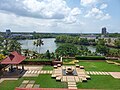
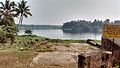
Kochi (Malayalam: കൊച്ചി, formerly known as Cochin) is a city in the Indian state of Kerala. Kochi is located in the district of Ernakulam, about 220 km north of the state capital Thiruvananthapuram. Old Kochi loosely refers to a group of islands including Willingdon Island, Fort Kochi and Mattancherry. Today Kochi includes Ernakulam, old parts of Kochi, Kumbalangi, and outlying islands. For centuries up to and during the British Raj, the city of Kochi was the seat of the eponymous princely state — the Kingdom of Cochin.
Subcategories
This category has the following 15 subcategories, out of 15 total.
Media in category "Geography of Kochi, Kerala"
The following 10 files are in this category, out of 10 total.
-
 Kochi landscape from Crowne Plaza Kochi 02.jpg 9,248 × 6,936; 10.7 MB
-
 Kochi landscape from Crowne Plaza Kochi.jpg 9,248 × 6,936; 13.18 MB
-
 Kochi landscape view from Kochi Marriott Hotel 02.jpg 9,248 × 6,936; 14.64 MB
-
 Kochi landscape view from Kochi Marriott Hotel 03.jpg 9,248 × 6,936; 19.59 MB
-
 Kochi landscape view from Kochi Marriott Hotel 04.jpg 9,248 × 6,936; 14.11 MB
-
 Kochi landscape view from Kochi Marriott Hotel.jpg 9,248 × 6,936; 14.69 MB
-
 Kochi Metro Kadavanthra landscape 01.jpg 9,248 × 6,936; 12.88 MB
-
 Kochi Metro Kadavanthra landscape 05.jpg 9,248 × 6,936; 12.27 MB
-
 Puzha.jpg 2,560 × 1,440; 1.4 MB
-
 Taken from train, Periyar River, Alwaye, Ernakulam C360 2013-08-10-09-45-44.jpg 2,592 × 1,944; 544 KB


