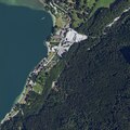
Category:Geography of Kochel am See
Appearance
Subcategories
This category has the following 14 subcategories, out of 14 total.
B
- Bergelskopf (1 F)
F
G
- Glaswand (5 F)
H
K
L
- Lainbach (Kochelsee) (2 F)
R
- Rohrsee (Kochel am See) (6 F)
S
- Sonnenspitz (Kochel) (1 F)
W
Media in category "Geography of Kochel am See"
The following 19 files are in this category, out of 19 total.
-
Aerials Bavaria 16.06.2006 12-02-38.jpg 2,048 × 1,536; 2.32 MB
-
Bach am Altjoch bei Kochel am See.jpg 3,264 × 1,840; 3.55 MB
-
Bay uraufnahme blatt 837.jpg 1,394 × 1,394; 437 KB
-
DOP40 - Landkreis Bad Tölz-Wolfratshausen 32677 5279 (Bayerische Vermessungsverwaltung).tif 2,500 × 2,500; 14.38 MB
-
GER Kochel am See, Am Aspensteinbichl 008.jpg 4,032 × 3,024; 2.74 MB
-
GER Kochel am See, Schlehdorfer Straße 004.jpg 4,032 × 3,024; 2.45 MB
-
Kochel am See (Seeufer, beim Bootsverleih) - Kleine Gartenanlage.JPG 3,648 × 2,736; 4.22 MB
-
Kochel am See - geo.hlipp.de - 25331.jpg 640 × 425; 65 KB
-
Kochel am See Parkplatz Uferbereich2016-01-07 14-25-21 - 0018.JPG 5,015 × 3,299; 5.52 MB
-
Kochel am See.jpg 2,496 × 1,664; 1.75 MB
-
Kochel mit See vom Rabenkopf 2015-06.jpg 5,472 × 3,648; 13.4 MB
-
Martinskopf - geo.hlipp.de - 28144.jpg 640 × 406; 75 KB
-
Mountain view Kochelsee 05052016.jpg 3,264 × 1,840; 2.37 MB
-
Oberhalb der Rappinalm - panoramio.jpg 1,200 × 1,600; 511 KB
-
Schilf am Kochelsee - geo.hlipp.de - 25335.jpg 640 × 426; 79 KB
-
Walchensee und Kochelsee Karte Adrian von Riedl 1806.jpg 6,731 × 4,936; 10.58 MB
-
Wiese bei Kochel - geo.hlipp.de - 25336.jpg 640 × 426; 68 KB


