Category:Geography of Kashmar County
Jump to navigation
Jump to search
- Counties of Razavi Khorasan Province
- Bajestan
- Bakharz
- Bardaskan
- Chenaran
- Dargaz
- Davarzan
- Fariman
- Firuzeh
- Golbahar
- Gonabad
- Joghatai
- Joveyn
- Kalat
- Kashmar
- Khaf
- Khalilabad
- Khoshab
- Kuhsorkh
- Mahvelat
- Mashhad
- Miyan Jolgeh
- Nishapur
- Quchan
- Roshtkhar
- Sabzevar
- Salehabad
- Sarakhs
- Sheshtamad
- Taybad
- Torbat-e Heydarieh
- Torbat-e Jam
- Torqabeh and Shandiz
- Zaveh
- Zeberkhan
Wikimedia category | |||||
| Upload media | |||||
| Instance of | |||||
|---|---|---|---|---|---|
| Category combines topics | |||||
| Category contains | |||||
| Kashmar County | |||||
county in Razavi Khorasan Province, Iran   | |||||
| Instance of | |||||
| Location | Razavi Khorasan Province, Iran | ||||
| Capital | |||||
| Official language | |||||
| Population |
| ||||
| Area |
| ||||
| Elevation above sea level |
| ||||
| official website | |||||
 | |||||
Subcategories
This category has the following 7 subcategories, out of 7 total.
- Geography of Farg Qaleh (1 F)
A
- Abgarm Valley (Kashmar County) (62 F)
- Atashgah Cave (13 F)
K
P
S
- Sang Nesveh River (16 F)
Media in category "Geography of Kashmar County"
The following 15 files are in this category, out of 15 total.
-
 Bala Velayat Rural District.svg 438 × 375; 12 KB
-
 Central District of Kashmar.svg 438 × 375; 11 KB
-
 Farahdasht District of Kashmar.svg 438 × 375; 11 KB
-
 ISS022-E-32920 - View of Earth.jpg 4,288 × 2,848; 818 KB
-
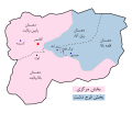
 Kashmar Constituency.png 2,000 × 1,859; 112 KB
-
 Kashmar County 1986.svg 617 × 420; 48 KB
-
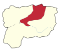
 Kashmar county 2024.svg 438 × 375; 15 KB
-
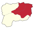
 Kashmar County colorful.svg 438 × 375; 11 KB
-
 Kashmar County Locator Map.svg 641 × 590; 183 KB
-
 Kashmar County Map.svg 618 × 586; 8 KB
-
 Location of Torshiz.svg 1,200 × 1,071; 476 KB
-
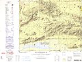 NI 40-3 Kashmar, Iran.jpg 5,000 × 3,777; 3.83 MB
-
 Pain Velayat Rural District.svg 438 × 375; 12 KB
-
 Qaleh-ye Bala Rural District.svg 438 × 375; 11 KB
-
 Rezqabad Rural District.svg 438 × 375; 11 KB


