Category:Geography of Hidalgo
Jump to navigation
Jump to search
Set of physical characteristics of Hidalgo, Mexico | |||||
| Upload media | |||||
| Instance of |
| ||||
|---|---|---|---|---|---|
| |||||
Subcategories
This category has the following 17 subcategories, out of 17 total.
B
D
G
H
L
M
N
P
T
Media in category "Geography of Hidalgo"
The following 44 files are in this category, out of 44 total.
-
 An der Autobahn Hidalgo - Mexiko Stadt.jpg 960 × 720; 104 KB
-
 Calor nenjo - panoramio.jpg 3,648 × 2,736; 2.83 MB
-
 Camino a La Palma, Jacala Hgo..jpg 2,592 × 1,944; 847 KB
-
 Camino a Zimapan. 01.jpg 3,264 × 2,312; 1.38 MB
-
 Camino a Zimapan. 02.jpg 3,264 × 2,026; 903 KB
-
 Camino a Zimapan. 04.jpg 3,264 × 2,448; 1,008 KB
-
 Camino a Zimapan. 05.jpg 3,264 × 2,448; 1.35 MB
-
 Camino a Zimapan. 06.jpg 3,264 × 2,448; 1.09 MB
-
 Camino a Zimapan. 07.jpg 3,264 × 2,448; 2.2 MB
-
 Camino a Zimapan. 08.jpg 3,264 × 2,448; 1.79 MB
-
 Camino al Nenjo Hgo - panoramio.jpg 3,648 × 2,432; 1.78 MB
-
 Camino al nenjo hgo con neblina - panoramio.jpg 3,648 × 2,736; 2.16 MB
-
 Camino al rio - panoramio.jpg 3,648 × 2,736; 3.97 MB
-
 Camino. Nicolás Flores, Hgo. - panoramio.jpg 1,200 × 1,600; 376 KB
-
 Cerca del nenjo - panoramio.jpg 3,648 × 2,736; 1.74 MB
-
 Cerritos.jpg 1,600 × 1,200; 416 KB
-
 Cerro Colorado Hidalgo - panoramio.jpg 5,184 × 3,456; 6.62 MB
-
 Cerro de la Aguja.jpg 1,704 × 2,272; 414 KB
-
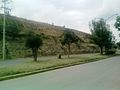
 CerroXicucoTezontepecAldama.jpg 1,600 × 1,200; 362 KB
-
 CerroXicucoTezontepecAldama2.jpg 1,600 × 1,200; 464 KB
-
 Clima de la comunidad.jpg 604 × 453; 52 KB
-
 EN PLENO VUELO.jpg 4,896 × 3,672; 4.02 MB
-
 ENTRE EL FUEJO.jpg 4,896 × 3,672; 3.42 MB
-
 Estratos en Hidalgo.jpg 3,264 × 1,836; 3 MB
-
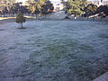 Helada Pachuca.jpg 2,560 × 1,920; 2.05 MB
-
 Hidalgo field.gif 1,172 × 510; 37.33 MB
-
 Huracan nenjo 2010 - panoramio.jpg 3,648 × 2,736; 2.1 MB
-
 Jales de pachuca 1.jpg 1,600 × 1,200; 619 KB
-
 La choza de Doña Faustina.JPG 6,000 × 4,000; 11.47 MB
-
 La Ciénega.jpg 1,123 × 842; 247 KB
-
 La leña, Hidalgo, México - panoramio (1).jpg 2,560 × 1,920; 1.79 MB
-
 La leña, Hidalgo, México - panoramio.jpg 2,560 × 1,920; 1.54 MB
-
 Largo camino.JPG 6,000 × 4,000; 10.06 MB
-
 Luna en Hidalgo.jpg 4,000 × 2,672; 1,007 KB
-
 Luz de la explanada.JPG 6,000 × 4,000; 4.38 MB
-
 Nopal al atardecer.jpg 4,000 × 2,672; 3.07 MB
-
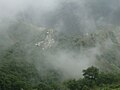
 Real-del-monte-nublado.jpg 640 × 286; 47 KB
-
 Santiago Tezontlale (4).jpg 5,152 × 3,864; 7.95 MB
-
 SFO2.JPG 2,048 × 1,536; 596 KB
-
 SFO3.JPG 2,048 × 1,536; 553 KB
-
 Tadeaca.jpg 1,600 × 1,200; 529 KB
-
 Tenango de Doria, Hidalgo, Mexico (1).jpg 1,024 × 768; 145 KB
-
 Tenango de Doria, Hidalgo, Mexico (3).jpg 1,024 × 768; 105 KB
-
 Tenango de Doria, Hidalgo, Mexico (4).jpg 1,024 × 768; 152 KB


.jpg)


.jpg)


.jpg)
.jpg)
.jpg)