Category:Geography of Fjord
Jump to navigation
Jump to search
Wikimedia category | |||||
| Upload media | |||||
| Instance of | |||||
|---|---|---|---|---|---|
| Category combines topics | |||||
| geography | |||||
science that studies the terrestrial surface, the societies that inhabit it and the territories, landscapes, places or regions that form it when interacting with each other     | |||||
| Pronunciation audio | |||||
| Instance of |
| ||||
| Different from | |||||
| Partially coincident with | |||||
| Fjord Municipality | |||||
municipality in Møre og Romsdal, Norway   | |||||
| Instance of | |||||
| Location | Møre og Romsdal, Norway | ||||
| Capital |
| ||||
| Head of government |
| ||||
| Inception |
| ||||
| Population |
| ||||
| Area | |||||
| Replaces | |||||
| official website | |||||
 | |||||
Subcategories
This category has the following 8 subcategories, out of 8 total.
Media in category "Geography of Fjord"
The following 34 files are in this category, out of 34 total.
-
 20131012 170448 Skrenakken, Storfjorden.jpg 3,264 × 2,448; 2.7 MB
-
 Cottage Cottage Cottage Cottage.jpg 4,095 × 2,720; 7.49 MB
-
 Dala sheep wandering on Valldalsvegen in Meiadalen, Fjord, Norway, 2019 July.jpg 3,000 × 1,764; 3.5 MB
-
 Dale (Norddal) kyrkje i kontekst.jpg 2,035 × 1,564; 786 KB
-
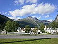
 Eidsdal sentrum.jpg 1,024 × 710; 369 KB
-
 Eidsdal.JPG 3,008 × 2,000; 2.4 MB
-
 Fall Colours, along Route 63, Norway.jpg 3,648 × 2,056; 4.85 MB
-
 Farm Houses beside Road 63 - 2013.08 - panoramio.jpg 3,992 × 2,994; 1.91 MB
-
 Groetet fraavest.JPG 1,280 × 960; 287 KB
-
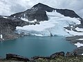
 Heimste Kaldhussætervatnet.JPG 2,848 × 2,136; 1.46 MB
-
 Herdalssetra.jpg 1,506 × 966; 352 KB
-
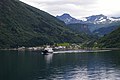
 Hurtigruten (cropped).JPG 1,163 × 652; 304 KB
-
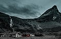
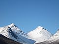
 Karitinden.jpg 500 × 375; 41 KB
-
 Mefjellet.JPG 1,280 × 960; 319 KB
-
 MS-Midnatsol im Storfjord 1127 (cropped).JPG 2,798 × 399; 391 KB
-
 MS-Midnatsol im Storfjord 1127.JPG 3,872 × 2,592; 2.29 MB
-
 Norddal.JPG 1,720 × 1,043; 656 KB
-
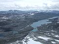
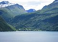 Norddalsfjorden Dalsbygda.JPG 3,255 × 2,360; 1.46 MB
-
 Norway-7322.jpg 5,184 × 3,456; 8.97 MB
-
 Ormula.JPG 1,280 × 960; 286 KB
-
 Solskjel Storfjorden.jpg 1,600 × 1,200; 598 KB
-
 Steingard Veslejordshornet Norddal 2010.jpg 1,804 × 1,215; 1.75 MB
-
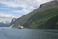
 Sunnylvsfjord MS-Midnatsol.jpg 1,744 × 1,392; 468 KB
-
 Sylte i Valldal med Syltefjellet.JPG 1,919 × 1,770; 530 KB
-
 Tafjorden Fjørå.JPG 3,475 × 2,180; 1.37 MB
-
 Tafjordfjella.JPG 3,648 × 2,736; 3.88 MB
-
 Tafjordvegen Muldalsvika.JPG 3,369 × 2,391; 2.2 MB
-
 Taskedalstind Valldal.jpg 1,216 × 912; 255 KB
-
 Tordsnose in Skjåk and Norddal.JPG 2,848 × 2,136; 1.42 MB
-
 Torvloeysa.JPG 1,280 × 960; 267 KB
-
 Tretindanibba.jpg 3,968 × 2,976; 3.2 MB
-
 Trollstigen2021fromsouht.jpg 3,216 × 2,136; 2.67 MB
-
 Valldal Syltefjellet frå fjorden.JPG 2,880 × 1,706; 861 KB
-
 Vikvatnet in Norddal.JPG 2,848 × 2,136; 1.43 MB


_kyrkje_i_kontekst.jpg)


.JPG)


.JPG)