Category:Geography of Coonoor
Jump to navigation
Jump to search
Subcategories
This category has the following 5 subcategories, out of 5 total.
A
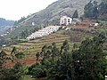
- Agricultural terraces in Coonoor (10 F)
D
- Dolphin's Nose, Coonoor (6 F)
H
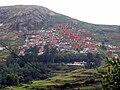
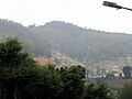
- Hills of Coonoor (35 F)
T
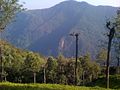
- Tea plantations in Coonoor (31 F)
U
- Upper Bhavani Lake (5 F)
Media in category "Geography of Coonoor"
The following 27 files are in this category, out of 27 total.
-
 Conoor 5-8-2012 1-51-43 PM.JPG 1,600 × 1,200; 614 KB
-
 Conoor 5-8-2012 1-51-52 PM.JPG 1,600 × 1,200; 542 KB
-
 Conoor 5-8-2012 1-53-05 PM.JPG 1,402 × 1,198; 492 KB
-
 Conoor 5-8-2012 1-53-47 PM.JPG 1,600 × 1,200; 682 KB
-
 Conoor 5-8-2012 12-06-23 PM.JPG 1,600 × 1,200; 360 KB
-
 Conoor view.jpg 4,128 × 3,096; 1.85 MB
-
 Conoor-Nilgiris.jpg 2,048 × 1,536; 1.02 MB
-
 Coonoor - കൂന്നൂർ 05.jpg 3,648 × 2,736; 2.48 MB
-
 Coonoor Stadt im Tal.JPG 2,592 × 1,944; 1.18 MB
-
 Coonoor Stadt.JPG 2,592 × 1,944; 1.25 MB
-
 Coonoor Stadtbild.JPG 2,592 × 1,944; 1.23 MB
-
 Coonoor tea Estate - panoramio.jpg 640 × 480; 72 KB
-
 CoonoorEstate.jpg 6,000 × 4,000; 9.37 MB
-
 Enroute coonoor.jpg 2,592 × 1,944; 754 KB
-
 Landschaft in der Nähe der Stadt Coonoor.JPG 2,592 × 1,944; 1.22 MB
-
 Long shola stream near DSSC.JPG 1,944 × 2,592; 1.11 MB
-
 Marshy swamps near DSSC.JPG 2,592 × 1,944; 1.2 MB
-
 Mobilfunkmasten in der Nähe von Coonoor.JPG 2,592 × 1,944; 1.08 MB
-
 Monkey At Sleeping Lady View Point, Ooty, India 001.jpg 4,320 × 3,240; 5.42 MB
-
 Monkey At Sleeping Lady View Point, Ooty, India 002.jpg 4,320 × 3,240; 5.64 MB
-
 Nilgiris district map 1953 with legend.jpg 3,312 × 2,704; 4.28 MB
-
 Path in the Jungle, Suicide Point, Coonoor.jpg 1,746 × 3,104; 1.81 MB
-
 Small shola stream two.JPG 2,592 × 1,944; 1.22 MB
-
 Small Shola stream.JPG 2,592 × 1,944; 1.2 MB
-
 Swamps 1 near DSSC.JPG 2,592 × 1,944; 1.21 MB
-
 Swamps 2 near DSSC.JPG 2,592 × 1,944; 1.19 MB
-
 The Sleeping Lady mountain at Ooty.jpg 4,128 × 2,322; 1.91 MB


