Category:Geography of Cúcuta
Jump to navigation
Jump to search
 | |||||
| Upload media | |||||
| Instance of |
| ||||
|---|---|---|---|---|---|
| Location | Cúcuta, Norte de Santander Department, Colombia | ||||
| |||||
Subcategories
This category has the following 2 subcategories, out of 2 total.
M
R
Media in category "Geography of Cúcuta"
The following 65 files are in this category, out of 65 total.
-
 A I CD de Cúcuta.JPG 4,608 × 2,548; 4.54 MB
-
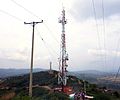 Antena torre en Cúcuta.JPG 3,366 × 2,800; 1.02 MB
-
 Atardecer Cucuta Colombia.jpg 5,184 × 3,456; 2.11 MB
-
 Avenida en Cúcuta NS, Col.JPG 4,608 × 2,400; 683 KB
-
 B aeropuerto, Cúcuta NS - Colombia.JPG 4,000 × 1,883; 1.2 MB
-
 Barrio San Rafael ,Cúcuta.JPG 3,968 × 1,819; 1.06 MB
-
 Cancha de tierra en Sevilla , Cúcuta.JPG 4,608 × 2,555; 3.96 MB
-
 Cerro Antonia Santos,Cúcuta.jpg 3,264 × 1,983; 929 KB
-
 Cerro tasajero y Cúcuta.JPG 4,000 × 2,623; 4.64 MB
-
 Cerros de Atalaya - Cúcuta NS, Col.JPG 1,024 × 614; 282 KB
-
 Colombia-Venezuela border from space.jpg 3,032 × 1,904; 1,014 KB
-
 Cucuta, North Santander, Colombia - panoramio (1).jpg 4,320 × 2,432; 1.79 MB
-
 Cucuta, North Santander, Colombia - panoramio (19).jpg 4,320 × 2,432; 3.11 MB
-
 Cucuta, North Santander, Colombia - panoramio (20).jpg 4,320 × 2,432; 3.28 MB
-
 Cucuta, North Santander, Colombia - panoramio (21).jpg 4,320 × 2,432; 2.29 MB
-
 Cucuta, North Santander, Colombia - panoramio (22).jpg 4,320 × 2,432; 2.83 MB
-
 Cucuta, North Santander, Colombia - panoramio (28).jpg 4,320 × 2,432; 2.84 MB
-
 Cucuta, North Santander, Colombia - panoramio (3).jpg 4,320 × 2,432; 2.8 MB
-
 Cucuta, North Santander, Colombia - panoramio (32).jpg 4,320 × 2,432; 2.24 MB
-
 Cucuta, North Santander, Colombia - panoramio (35).jpg 4,320 × 2,432; 2.98 MB
-
 Cucuta, North Santander, Colombia - panoramio (51).jpg 4,320 × 2,432; 2.59 MB
-
 Cucuta, North Santander, Colombia - panoramio (60).jpg 4,320 × 2,432; 3.14 MB
-
 Cucuta, North Santander, Colombia - panoramio (63).jpg 4,320 × 2,432; 2.83 MB
-
 Cucuta, North Santander, Colombia - panoramio (73).jpg 4,320 × 2,432; 2.41 MB
-
 Cucuta, North Santander, Colombia - panoramio (75).jpg 3,152 × 936; 957 KB
-
 Cucuta, North Santander, Colombia - panoramio.jpg 4,320 × 2,432; 2.34 MB
-
 Cúcuta - Panorámica II.jpg 1,024 × 768; 242 KB
-
 Cúcuta 3 NS enero 2018.jpg 4,608 × 2,280; 6.15 MB
-
 Cúcuta 4 NS enero 2018.jpg 4,608 × 2,592; 7.21 MB
-
 Cúcuta 5 NS enero 2018.jpg 4,534 × 2,108; 6.63 MB
-
 Cúcuta a 600 m.JPG 4,000 × 1,347; 3.44 MB
-
 Cúcuta desde la avenida del Indio.JPG 4,608 × 2,632; 4.19 MB
-
 Cúcuta desde los cerros de La Libertad.jpeg 3,648 × 2,017; 2.38 MB
-
 Cúcuta NS enero 2018.jpg 4,608 × 2,407; 6.06 MB
-
 Cúcuta NS,Colombia, Nueva Av 0.JPG 3,968 × 2,232; 1.28 MB
-
 Cúcuta, Cucuta, North Santander, Colombia - panoramio (1).jpg 4,320 × 2,432; 918 KB
-
 Desde el Ventura Plaza Cúcuta.jpeg 3,264 × 2,448; 3.2 MB
-
 Entrada peatonal del barrio la Cruz, Cúcuta.JPG 4,608 × 3,456; 5.68 MB
-
 Este 2 de Cúcuta NS enero 2018.jpg 4,608 × 2,592; 7.33 MB
-
 Este de Cúcuta NS enero 2018.jpg 4,608 × 2,479; 2.35 MB
-
 Este de Cúcuta y Ureña enero 2018.jpg 3,264 × 1,836; 2.68 MB
-
 Helicóptero negro cuc.JPG 4,000 × 2,343; 4.86 MB
-
 Laguna San Luis.JPG 3,968 × 2,232; 4.13 MB
-
 Límite noroeste de Cúcuta.jpg 1,600 × 987; 385 KB
-
 Montañas al fondo Cúcuta.jpeg 3,264 × 2,448; 2.3 MB
-
 Montañas al noreste de Cúcuta.jpg 1,600 × 990; 428 KB
-
 Montañas al norte de Cúcuta .4.JPG 4,000 × 2,064; 4.13 MB
-
 Montañas al norte de Cúcuta .5.JPG 4,000 × 2,273; 5.83 MB
-
 Montañas del sur de Cúcuta NS . 2.JPG 4,000 × 2,051; 3.71 MB
-
 Montañas del sur de Cúcuta NS.JPG 4,000 × 2,750; 5.46 MB
-
 Noroeste de Cúcuta NS, Colombia.JPG 4,608 × 3,456; 5.31 MB
-
 Nueva Av 0 Cúcuta NS.jpg 2,592 × 1,664; 1.25 MB
-
 Paisaje oeste de Cúcuta NS, Col.JPG 4,608 × 2,429; 4.3 MB
-
 Pamplonita anillo.JPG 3,968 × 1,499; 3.17 MB
-
 Pamplonita en J.G. Durán 2.JPG 3,968 × 1,974; 4.29 MB
-
 Pamplonita en s. Rafael.JPG 3,968 × 1,816; 4.24 MB
-
 Río Pamplonita - Cúcuta, Colombia.jpg 1,024 × 768; 238 KB
-
 Río Pamplonita desde el ct.JPG 4,000 × 2,211; 4.73 MB
-
 Río pamplonita desde el mt tasajero.JPG 4,000 × 2,245; 4.78 MB
-
 Río pamplonita norte de Cúcuta.JPG 4,000 × 2,482; 5.09 MB
-
 Río pamplonita y el mt tasajero 2.JPG 4,000 × 2,623; 5.29 MB
-
 Río pamplonita y el mt tasajero.JPG 4,000 × 2,523; 5.91 MB
-
 Sector seguro, camino seguro (14277198236).jpg 1,286 × 854; 849 KB
-
 Ureña y Cúcuta .2.JPG 4,895 × 2,028; 7.47 MB
-
 Venezuela y Colombia.JPG 4,000 × 2,471; 5.65 MB


.jpg)
.jpg)
.jpg)
.jpg)
.jpg)
.jpg)
.jpg)
.jpg)
.jpg)
.jpg)
.jpg)
.jpg)
.jpg)


.jpg)


.jpg)


.jpg)