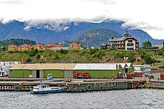
Category:Geography of Aysén Region
Jump to navigation
Jump to search
Regions of Chile: Arica y Parinacota · Tarapacá · Antofagasta · Atacama · Coquimbo · Valparaíso · Santiago · O'Higgins · Maule · Ñuble · Biobío · Araucanía · Los Ríos · Los Lagos · Aysén · Magallanes
Wikimedia category | |||||
| Upload media | |||||
| Instance of | |||||
|---|---|---|---|---|---|
| Category combines topics | |||||
| geography | |||||
science that studies the terrestrial surface, the societies that inhabit it and the territories, landscapes, places or regions that form it when interacting with each other | |||||
| Pronunciation audio | |||||
| Instance of |
| ||||
| Different from | |||||
| Partially coincident with | |||||
| Aysén Region | |||||
administrative division of Chile | |||||
| Instance of |
| ||||
| Location | Chile | ||||
| Capital | |||||
| Legislative body |
| ||||
| Population |
| ||||
| Area |
| ||||
| Elevation above sea level |
| ||||
| official website | |||||
 | |||||
Subcategories
This category has the following 14 subcategories, out of 14 total.
B
- Beaches of Aysén Region (1 F)
C
D
- Dos Lagunas (5 F)
E
- Estancia Chacabuco (8 F)
- Estero Quitralco (2 F)
I
L
M
P
- Puerto Chacabuco (35 F)
R
T
- Taitao Peninsula (10 F)
Media in category "Geography of Aysén Region"
The following 23 files are in this category, out of 23 total.
-
Amanecer nublado.jpg 4,128 × 2,322; 2.16 MB
-
Araña en un "Cadillo".JPG 4,288 × 3,216; 3.49 MB
-
Aysen Chilean Patagonia.JPG 3,008 × 2,000; 1.91 MB
-
AYSEN.JPG 3,008 × 2,000; 2.2 MB
-
Caleta Bertrand.JPG 1,584 × 2,816; 974 KB
-
Camino a Puerto Raul Marin.JPG 4,608 × 2,592; 5.85 MB
-
Camino al centro de Ski "El Fraile" en Coyhaique.JPG 1,600 × 1,200; 754 KB
-
Coyhaique y cerro Mackay.JPG 4,000 × 2,200; 3.14 MB
-
CoyhaiqueSep13Aisen16.JPG 4,576 × 2,576; 4.76 MB
-
CoyhaiqueSep13Aisen35.JPG 4,049 × 2,280; 2.79 MB
-
CoyhaiqueSep13Baquedano04.JPG 3,885 × 2,190; 4.38 MB
-
Mañihuales 10.jpg 2,144 × 1,424; 3 MB
-
Mañihuales 2.jpg 2,097 × 1,290; 1.11 MB
-
Mañihuales 7.jpg 2,144 × 1,424; 1.75 MB
-
Montaña al suroeste de Puerto Aysén.JPG 4,000 × 3,000; 2.2 MB
-
Puerto Yungay.JPG 1,584 × 2,816; 1,020 KB
-
Puntiagudo 1.jpg 1,958 × 1,236; 1.83 MB
-
Salto rio - panoramio.jpg 4,608 × 3,456; 10.03 MB
-
Seno Ventisquero 3.jpg 2,144 × 1,424; 2.8 MB
-
Vista al "Queque Inglés".jpg 1,536 × 2,048; 425 KB
-
Vista del "Cerro Castillo" desde Aysén.JPG 4,288 × 3,216; 2.66 MB
-
Vista del camino a Coyhaique desde el Cerro Cordón.jpg 2,560 × 1,920; 651 KB
-
Vista desde Cerro Castillo hacia Río Ibáñez.jpg 4,608 × 3,456; 5.02 MB


