Category:Geographical Regions of Hidalgo
Jump to navigation
Jump to search
Media in category "Geographical Regions of Hidalgo"
The following 19 files are in this category, out of 19 total.
-
 Mapa Comarca Minera.svg 1,192 × 1,061; 402 KB
-
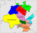
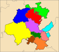 Mapa de las Regiones geográficas del estado de Hidalgo.svg 1,192 × 1,061; 413 KB
-
 Mapa Sierra de Tenango.svg 1,192 × 1,061; 402 KB
-
 Mapa Valle del Mezquital.svg 512 × 472; 237 KB
-
 Region Geografica de Hidalgo - Altiplanicie pulquera.png 1,192 × 1,061; 168 KB
-
 Region Geografica de Hidalgo - Comarca Minera.png 1,192 × 1,061; 168 KB
-
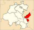
 Region Geografica de Hidalgo - Cuenca de México.png 1,192 × 1,061; 168 KB
-
 Region Geografica de Hidalgo - Huasteca hidalguense.png 1,192 × 1,061; 167 KB
-
 Region Geografica de Hidalgo - Sierra Alta.png 1,192 × 1,061; 168 KB
-
 Region Geografica de Hidalgo - Sierra Baja.png 1,192 × 1,061; 168 KB
-
 Region Geografica de Hidalgo - Sierra de Tenango.png 1,192 × 1,061; 168 KB
-
 Region Geografica de Hidalgo - Sierra Gorda.png 1,192 × 1,061; 168 KB
-
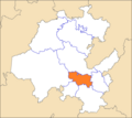
 Region Geografica de Hidalgo - Valle de Tulancingo.png 1,192 × 1,061; 168 KB
-
 Region Geografica de Hidalgo - Valle del Mezquital.png 1,192 × 1,061; 168 KB
-
 Regiones Geograficas de Hidalgo 01.png 1,184 × 1,059; 239 KB
-
 Regiones Geograficas de Hidalgo 02.png 1,192 × 1,061; 265 KB
-
 Regiones Geograficas de Hidalgo 03.png 1,192 × 1,061; 166 KB
-
 Regiones hgo.gif 450 × 400; 61 KB
-
 Regiones Hidalgo ferfosado.svg 1,052 × 744; 21 KB


