Category:Geographic diagrams
Jump to navigation
Jump to search
Subcategories
This category has the following 11 subcategories, out of 11 total.
A
- Diagrams of altitudinal zones (21 F)
- Axial tilt (or Obliquity) (21 F)
C
H
- Horizon diagrams (42 F)
L
M
R
V
W
Pages in category "Geographic diagrams"
This category contains only the following page.
Media in category "Geographic diagrams"
The following 101 files are in this category, out of 101 total.
-
 Abflussganglinie.JPG 674 × 434; 24 KB
-
 Altitude (PSF).png 800 × 324; 34 KB
-
 Analisis Espacial.jpg 1,176 × 668; 48 KB
-
 Anchor-point theory in Japanese.png 1,228 × 792; 48 KB
-
 Arctic region.jpg 457 × 434; 54 KB
-
 Auxiliary Latitudes Difference.svg 540 × 360; 47 KB
-
 Bollenkubus web.jpg 500 × 380; 31 KB
-
 Cercleste.svg 478 × 396; 14 KB
-
 Christaller model 1.jpg 300 × 288; 31 KB
-
 Christaller model 1.svg 270 × 279; 65 KB
-
 Christaller model 2.jpg 300 × 285; 26 KB
-
 Christaller model 3.jpg 200 × 201; 11 KB
-
 Christaller model 3.svg 200 × 200; 1 KB
-
 Christaller model2.jpg 300 × 309; 29 KB
-
 Circles of latitude.jpg 551 × 284; 43 KB
-
 Colure-it.png 634 × 590; 216 KB
-
 Colure-it.svg 774 × 684; 7.15 MB
-
 Colure.png 760 × 590; 222 KB
-
 Colure.svg 774 × 684; 7.18 MB
-
 Cylindrical Projection basics2.svg 503 × 231; 38 KB
-
 Cylindrical Projection secant.svg 489 × 206; 22 KB
-
 CylProj infinitesimals2.svg 495 × 142; 44 KB
-
 December solstice geometry ur.png 390 × 267; 35 KB
-
 December solstice geometry.svg 367 × 251; 98 KB
-
 Direction of qibla using shadow.svg 216 × 160; 4 KB
-
 EB1911 Geography - Continental slope.jpg 600 × 364; 82 KB
-
 EIA global transport energy by fuel 2012.png 499 × 271; 19 KB
-
 Enk.jpg 320 × 200; 11 KB
-
 Enkexk.jpg 320 × 200; 13 KB
-
 Eratosthene mesure terre.png 500 × 312; 70 KB
-
 Eratosthenes.svg 427 × 257; 102 KB
-
 Esfera armilar versão da geografia.jpg 846 × 1,104; 80 KB
-
 Esferageo.jpg 177 × 227; 10 KB
-
 Exk.jpg 320 × 200; 20 KB
-
 Figure de poles projection stereographique.png 1,015 × 302; 23 KB
-
 Föhn.svg 1,001 × 667; 26 KB
-
 Geographical matrix - approaches to geography.jpg 1,063 × 798; 123 KB
-
 Geographical matrix - systematic and regional geography.jpg 1,063 × 798; 111 KB
-
 Geographischer Formenwandel.png 533 × 364; 16 KB
-
 Geography Word Cloud.png 1,920 × 1,080; 683 KB
-
 Geonames4.png 1,440 × 720; 169 KB
-
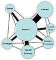 Grunddaseinsfunktionen.jpg 462 × 500; 72 KB
-
 Heliotermia.jpg 3,050 × 2,189; 695 KB
-
 Hoyt model.png 600 × 323; 17 KB
-
 Inversion by Stereographic.png 365 × 224; 5 KB
-
 Islands by area.png 781 × 745; 49 KB
-
 Kernmechanismus Sahel-Syndrom.pdf 1,239 × 1,752; 81 KB
-
 Kernmechanismus Sahel-Syndrom2.pdf 1,239 × 1,752; 81 KB
-
 Kriptodepresioni.jpg 2,000 × 942; 206 KB
-
 Landscape-sphere.jpg 640 × 480; 73 KB
-
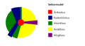
 Landusepiechart.png 537 × 501; 109 KB
-
 Location Theory by August Losch-de.svg 1,052 × 744; 38 KB
-
 Location Theory by August Losch-sr.svg 1,052 × 744; 38 KB
-
 Maury plate 01.jpg 2,723 × 2,947; 2.91 MB
-
 Nachylenie osi obrotu.svg 774 × 684; 7.15 MB
-
 Oceanic basin bangla.svg 1,001 × 705; 25 KB
-
 Oceanic basin bn.svg 1,001 × 705; 24 KB
-
 Orbita Tierra.jpg 720 × 635; 50 KB
-
 Orbita.tierra.Spanish.svg 728 × 624; 18 KB
-
 Osservazione celeste.png 760 × 590; 232 KB
-
 Ost.jpg 320 × 200; 20 KB
-
 Paralelos.png 591 × 443; 7 KB
-
 Pobreznyvanok.jpg 640 × 300; 10 KB
-
 Poledníky.png 450 × 366; 151 KB
-
 Pontos cardeais.png 400 × 149; 11 KB
-
 Prominence.png 1,600 × 999; 29 KB
-
 Rayos.png 770 × 495; 13 KB
-
 RotacionTerrestre.svg 154 × 182; 83 KB
-
 Sahel-syndrom.pdf 1,239 × 1,752; 92 KB
-
 Sahel-Syndrom.pdf 1,239 × 1,752; 92 KB
-
 Schaubild - Kulturlandschaft 2.png 1,301 × 780; 639 KB
-
 Sea-level-rise scheme.svg 842 × 595; 131 KB
-
 Skládání vrstev -7-.png 722 × 595; 73 KB
-
 Standard deviational ellipse.svg 542 × 755; 37 KB
-
 Table of Geography and Hydrography, Cyclopaedia, Volume 1.jpg 1,809 × 2,725; 2.22 MB
-
 Tageslaenge es.svg 1,946 × 1,465; 23 KB
-
 Temperate zone (PSF).png 3,506 × 1,697; 595 KB
-
 Temperate zone (PSF).svg 526 × 255; 428 KB
-
 Temperature zone of earth.jpg 2,560 × 1,920; 912 KB
-
 Trends des Globalen Wandels.pdf 1,239 × 1,752; 141 KB
-
 Trends des Globalen Wandels2.pdf 1,239 × 1,752; 141 KB
-
 Types of latitude difference.png 512 × 384; 4 KB
-
 Types of latitude difference.svg 640 × 480; 28 KB
-
 Types of latitudes original.png 512 × 384; 4 KB
-
 Valaistusvyohykkeet.png 1,305 × 916; 50 KB
-
 Vertikální členění reliéfu.png 1,563 × 931; 95 KB
-
 Von thunen circles city.gif 443 × 363; 4 KB
-
 Von Thunen Model.svg 1,200 × 900; 17 KB
-
 Von Thünen circles city.svg 300 × 300; 4 KB
-
 WeierstrassSubstitution.svg 345 × 210; 7 KB
-
 Wiki WC n7 pb solution.jpg 485 × 700; 99 KB
-
 Wiki WC n7 pb.jpg 486 × 701; 126 KB
-
 World Scale from DMA Series 1150 map.png 3,301 × 890; 14 KB
-
 Zentraleorte.jpg 250 × 231; 17 KB
-
 Zentralitaet k3.png 214 × 234; 3 KB
-
 Zonas terra.png 527 × 535; 60 KB
-
 Zuordnung Kernprobleme.pdf 1,239 × 1,752; 206 KB
-
 Órbita da Terra.jpg 438 × 365; 20 KB
-
 ПТКомплекс.jpg 500 × 500; 137 KB
-
 צלבי פיזור של גידולים חקלאיים.jpg 975 × 666; 100 KB
-
 華倫亭.png 990 × 569; 35 KB


.png)
.svg)


.png)