Category:Geografía de la República del Ecuador (1858) by VILLAVICENCIO
Jump to navigation
Jump to search

Español: Geografía de la República del Ecuador … (1858) by VILLAVICENCIO, Manuel
| This category includes images from a book scanned for the British Library Mechanical Curator collection.
The full set of images from the book is available on Flickr. |
1858 edition of book by Manuel Villavicencio | |||||
| Upload media | |||||
| Instance of |
| ||||
|---|---|---|---|---|---|
| Author |
| ||||
| Place of publication |
| ||||
| Distribution format |
| ||||
| Full work available at URL | |||||
| Collection | |||||
| Publication date |
| ||||
| |||||
Media in category "Geografía de la República del Ecuador (1858) by VILLAVICENCIO"
The following 14 files are in this category, out of 14 total.
-
 VILLAVICENCIO(1858) Geografia de la Republica del Ecuador.jpg 515 × 763; 43 KB
-
 Manuel VILLAVICENCIO(1858).jpg 847 × 1,160; 464 KB
-
 VILLAVICENCIO(1858) p063 CAYAMBI.jpg 1,481 × 1,144; 1.09 MB
-
 VILLAVICENCIO(1858) p063 CHIMBORAZO.jpg 1,467 × 1,157; 1.01 MB
-
 VILLAVICENCIO(1858) p071 COTOPAXI.jpg 1,483 × 1,153; 1 MB
-
 VILLAVICENCIO(1858) p071 PINCHINCHA.jpg 1,041 × 814; 578 KB
-
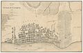
 VILLAVICENCIO(1858) p307 PLANO DE LA CIUDAD DE QUITO - 1858.jpg 2,352 × 1,480; 2.22 MB
-
 VILLAVICENCIO(1858) p358 PUENTE DE PENIPE.jpg 1,465 × 1,127; 951 KB
-
 VILLAVICENCIO(1858) p358 TARAVITA DE PATATE.jpg 1,477 × 1,131; 1.06 MB
-
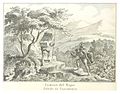 VILLAVICENCIO(1858) p366 CAMINO DEL NAPO.jpg 1,467 × 1,145; 1.15 MB
-
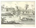 VILLAVICENCIO(1858) p366 SANTA ROSA DE OAS.jpg 1,467 × 1,155; 1.09 MB
-
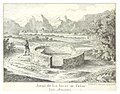 VILLAVICENCIO(1858) p468 JUEGO DE LOS INCAS.jpg 1,473 × 1,159; 1.18 MB
-
 VILLAVICENCIO(1858) p468 PALACIO DE LOS INCAS EN CANAR.jpg 1,467 × 1,159; 1,015 KB
-
 VILLAVICENCIO(1858) p483 PLANO DE LA CIUDAD DE GUAYAQUIL - 1858.jpg 2,347 × 1,504; 2.39 MB
_Geografia_de_la_Republica_del_Ecuador.jpg)
.jpg)
_p063_CAYAMBI.jpg)
_p063_CHIMBORAZO.jpg)
_p071_COTOPAXI.jpg)
_p071_PINCHINCHA.jpg)
_p307_PLANO_DE_LA_CIUDAD_DE_QUITO_-_1858.jpg)
_p358_PUENTE_DE_PENIPE.jpg)
_p358_TARAVITA_DE_PATATE.jpg)
_p366_CAMINO_DEL_NAPO.jpg)
_p366_SANTA_ROSA_DE_OAS.jpg)
_p468_JUEGO_DE_LOS_INCAS.jpg)
_p468_PALACIO_DE_LOS_INCAS_EN_CANAR.jpg)
_p483_PLANO_DE_LA_CIUDAD_DE_GUAYAQUIL_-_1858.jpg)