Category:Gemeenteweg 44, Staphorst
Jump to navigation
Jump to search
| Address |
|
| Object location | | View all coordinates using: OpenStreetMap |
|---|
Media in category "Gemeenteweg 44, Staphorst"
The following 6 files are in this category, out of 6 total.
-
 Gemeenteweg 44, Staphorst.JPG 3,646 × 2,732; 1.61 MB
-
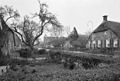 Overzicht - Staphorst - 20203884 - RCE.jpg 1,200 × 808; 260 KB
-
 Rechter zij- en achtergevel - Staphorst - 20203882 - RCE.jpg 1,185 × 1,200; 269 KB
-
 Vier boerderijen - Staphorst - 20507034 - RCE.jpg 1,200 × 900; 165 KB
-
 Voor- en rechter zijgevel - Staphorst - 20203881 - RCE.jpg 1,192 × 1,200; 292 KB
-
 Vooraanzicht - Staphorst - 20203883 - RCE.jpg 1,200 × 805; 191 KB


