Category:Gemeenteweg 167, Staphorst
Jump to navigation
Jump to search
| Object location | | View all coordinates using: OpenStreetMap |
|---|
_RM-34210-WLM.jpg) | |||||
| Upload media | |||||
| Instance of | |||||
|---|---|---|---|---|---|
| Location | Staphorst, Overijssel, Netherlands | ||||
| Street address |
| ||||
| Located on street |
| ||||
| Heritage designation |
| ||||
 | |||||
|
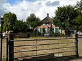
This is a category about rijksmonument number 34210
|
| Address |
|
Media in category "Gemeenteweg 167, Staphorst"
The following 5 files are in this category, out of 5 total.
-
 Aanzicht - Staphorst - 20204055 - RCE.jpg 1,200 × 809; 265 KB
-
 Staphorst, Gemeenteweg 167 (2) RM-34210-WLM.jpg 3,648 × 2,736; 3.27 MB
-
 Staphorst, Gemeenteweg 167 (3) RM-34210-WLM.jpg 3,645 × 2,404; 2.41 MB
-
 Staphorst, Gemeenteweg 167 (4) RM-34210-WLM.jpg 3,648 × 2,736; 2.62 MB
-
 Voor- en rechter zijgevel - Staphorst - 20204056 - RCE.jpg 1,197 × 1,200; 370 KB

_RM-34210-WLM.jpg)
_RM-34210-WLM.jpg)
